Saint-Soulan | |
|---|---|
Location of Saint-Soulan | |
 Saint-Soulan  Saint-Soulan | |
| Coordinates: 43°30′33″N 0°51′31″E / 43.5092°N 0.8586°E | |
| Country | France |
| Region | Occitania |
| Department | Gers |
| Arrondissement | Auch |
| Canton | Val de Save |
| Intercommunality | Savès |
| Government | |
| • Mayor (2020–2026) | Jacques Alfenore[1] |
| Area 1 | 12.31 km2 (4.75 sq mi) |
| Population | 162 |
| • Density | 13/km2 (34/sq mi) |
| Time zone | UTC+01:00 (CET) |
| • Summer (DST) | UTC+02:00 (CEST) |
| INSEE/Postal code | 32407 /32220 |
| Elevation | 174–302 m (571–991 ft) (avg. 285 m or 935 ft) |
| 1 French Land Register data, which excludes lakes, ponds, glaciers > 1 km2 (0.386 sq mi or 247 acres) and river estuaries. | |
Saint-Soulan (French pronunciation: [sɛ̃ sulɑ̃]; Gascon: Sent Solan) is a commune in the Gers department in southwestern France.
Geography
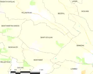
Saint-Soulan and its surrounding communes
Population
| Year | Pop. | ±% |
|---|---|---|
| 1962 | 192 | — |
| 1968 | 169 | −12.0% |
| 1975 | 141 | −16.6% |
| 1982 | 155 | +9.9% |
| 1990 | 145 | −6.5% |
| 1999 | 134 | −7.6% |
| 2008 | 144 | +7.5% |
See also
References
- ↑ "Répertoire national des élus: les maires". data.gouv.fr, Plateforme ouverte des données publiques françaises (in French). 9 August 2021.
- ↑ "Populations légales 2020". The National Institute of Statistics and Economic Studies. 29 December 2022.
Wikimedia Commons has media related to Saint-Soulan.
This article is issued from Wikipedia. The text is licensed under Creative Commons - Attribution - Sharealike. Additional terms may apply for the media files.