Arblade-le-Haut | |
|---|---|
.jpg.webp) The church in Arblade-le-Haut | |
Location of Arblade-le-Haut | |
 Arblade-le-Haut  Arblade-le-Haut | |
| Coordinates: 43°44′23″N 0°03′31″W / 43.7397°N 0.0586°W | |
| Country | France |
| Region | Occitania |
| Department | Gers |
| Arrondissement | Condom |
| Canton | Grand-Bas-Armagnac |
| Government | |
| • Mayor (2020–2026) | Jean-Marie Verrier[1] |
| Area 1 | 12.2 km2 (4.7 sq mi) |
| Population | 328 |
| • Density | 27/km2 (70/sq mi) |
| Time zone | UTC+01:00 (CET) |
| • Summer (DST) | UTC+02:00 (CEST) |
| INSEE/Postal code | 32005 /32110 |
| Elevation | 87–177 m (285–581 ft) (avg. 154 m or 505 ft) |
| 1 French Land Register data, which excludes lakes, ponds, glaciers > 1 km2 (0.386 sq mi or 247 acres) and river estuaries. | |
Arblade-le-Haut (French pronunciation: [aʁblad lə o]; Occitan: Arblada de'n Haut) is a commune in the Gers department in southwestern France.
Geography
Arblade-le-Haut is located in the canton of Grand-Bas-Armagnac and in the arrondissement of Condom.
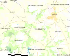
Map of Arblade-le-Haut and its surrounding communes
Population
| Year | Pop. | ±% |
|---|---|---|
| 1962 | 262 | — |
| 1968 | 246 | −6.1% |
| 1975 | 225 | −8.5% |
| 1982 | 261 | +16.0% |
| 1990 | 260 | −0.4% |
| 1999 | 276 | +6.2% |
| 2008 | 275 | −0.4% |
See also
References
- ↑ "Répertoire national des élus: les maires". data.gouv.fr, Plateforme ouverte des données publiques françaises (in French). 2 December 2020.
- ↑ "Populations légales 2020". The National Institute of Statistics and Economic Studies. 29 December 2022.
Wikimedia Commons has media related to Arblade-le-Haut.
This article is issued from Wikipedia. The text is licensed under Creative Commons - Attribution - Sharealike. Additional terms may apply for the media files.