Avéron-Bergelle | |
|---|---|
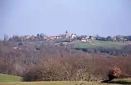 A general view of Avéron-Bergelle | |
Location of Avéron-Bergelle | |
 Avéron-Bergelle  Avéron-Bergelle | |
| Coordinates: 43°44′44″N 0°04′14″E / 43.7456°N 0.0706°E | |
| Country | France |
| Region | Occitania |
| Department | Gers |
| Arrondissement | Mirande |
| Canton | Adour-Gersoise |
| Intercommunality | CC Armagnac Adour |
| Government | |
| • Mayor (2020–2026) | Michel Lartigolle[1] |
| Area 1 | 14.7 km2 (5.7 sq mi) |
| Population | 176 |
| • Density | 12/km2 (31/sq mi) |
| Time zone | UTC+01:00 (CET) |
| • Summer (DST) | UTC+02:00 (CEST) |
| INSEE/Postal code | 32022 /32290 |
| Elevation | 109–196 m (358–643 ft) (avg. 160 m or 520 ft) |
| 1 French Land Register data, which excludes lakes, ponds, glaciers > 1 km2 (0.386 sq mi or 247 acres) and river estuaries. | |
Avéron-Bergelle (French pronunciation: [aveʁɔ̃ bɛʁʒɛl]; Occitan: Averon e Bergela) is a commune in the Gers department in southwestern France.
Geography
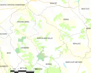
Avéron-Bergelle and its surrounding communes
Population
| Year | Pop. | ±% |
|---|---|---|
| 1962 | 245 | — |
| 1968 | 277 | +13.1% |
| 1975 | 233 | −15.9% |
| 1982 | 193 | −17.2% |
| 1990 | 174 | −9.8% |
| 1999 | 176 | +1.1% |
| 2008 | 161 | −8.5% |
| 2014 | 149 | −7.5% |
See also
References
- ↑ "Répertoire national des élus: les maires". data.gouv.fr, Plateforme ouverte des données publiques françaises (in French). 2 December 2020.
- ↑ "Populations légales 2020". The National Institute of Statistics and Economic Studies. 29 December 2022.
Wikimedia Commons has media related to Avéron-Bergelle.
This article is issued from Wikipedia. The text is licensed under Creative Commons - Attribution - Sharealike. Additional terms may apply for the media files.