Castillon-Savès | |
|---|---|
.svg.png.webp) Coat of arms | |
Location of Castillon-Savès | |
 Castillon-Savès  Castillon-Savès | |
| Coordinates: 43°34′14″N 0°59′11″E / 43.5706°N 0.9864°E | |
| Country | France |
| Region | Occitania |
| Department | Gers |
| Arrondissement | Auch |
| Canton | Val de Save |
| Government | |
| • Mayor (2020–2026) | Julien Délix[1] |
| Area 1 | 11.96 km2 (4.62 sq mi) |
| Population | 339 |
| • Density | 28/km2 (73/sq mi) |
| Time zone | UTC+01:00 (CET) |
| • Summer (DST) | UTC+02:00 (CEST) |
| INSEE/Postal code | 32090 /32490 |
| Elevation | 147–246 m (482–807 ft) (avg. 214 m or 702 ft) |
| 1 French Land Register data, which excludes lakes, ponds, glaciers > 1 km2 (0.386 sq mi or 247 acres) and river estuaries. | |
Castillon-Savès (French pronunciation: [kastijɔ̃ savɛs]; Occitan: Castilhon de Savés) is a commune in the Gers department in southwestern France.
Geography
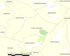
Castillon-Savès and its surrounding communes
Population
| Year | Pop. | ±% |
|---|---|---|
| 1962 | 245 | — |
| 1968 | 217 | −11.4% |
| 1975 | 160 | −26.3% |
| 1982 | 170 | +6.2% |
| 1990 | 174 | +2.4% |
| 1999 | 206 | +18.4% |
| 2008 | 295 | +43.2% |
See also
References
- ↑ "Répertoire national des élus: les maires" (in French). data.gouv.fr, Plateforme ouverte des données publiques françaises. 13 September 2022.
- ↑ "Populations légales 2020". The National Institute of Statistics and Economic Studies. 29 December 2022.
Wikimedia Commons has media related to Castillon-Savès.
This article is issued from Wikipedia. The text is licensed under Creative Commons - Attribution - Sharealike. Additional terms may apply for the media files.