Saint-Médard | |
|---|---|
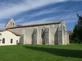 Church | |
Location of Saint-Médard | |
 Saint-Médard  Saint-Médard | |
| Coordinates: 45°23′30″N 0°21′14″W / 45.3917°N 0.3539°W | |
| Country | France |
| Region | Nouvelle-Aquitaine |
| Department | Charente-Maritime |
| Arrondissement | Jonzac |
| Canton | Jonzac |
| Government | |
| • Mayor (2020–2026) | Loïc Édouard[1] |
| Area 1 | 3.81 km2 (1.47 sq mi) |
| Population | 82 |
| • Density | 22/km2 (56/sq mi) |
| Time zone | UTC+01:00 (CET) |
| • Summer (DST) | UTC+02:00 (CEST) |
| INSEE/Postal code | 17372 /17500 |
| Elevation | 38–91 m (125–299 ft) |
| 1 French Land Register data, which excludes lakes, ponds, glaciers > 1 km2 (0.386 sq mi or 247 acres) and river estuaries. | |
Saint-Médard (French pronunciation: [sɛ̃ medaʁ]) is a commune in the Charente-Maritime department in the Nouvelle-Aquitaine region in southwestern France.
Geography
The village lies on the right bank of the Seugne, which flows northwest through the western part of the commune.
Population
| Year | Pop. | ±% |
|---|---|---|
| 1962 | 52 | — |
| 1968 | 58 | +11.5% |
| 1975 | 70 | +20.7% |
| 1982 | 55 | −21.4% |
| 1990 | 48 | −12.7% |
| 1999 | 72 | +50.0% |
| 2008 | 96 | +33.3% |
See also
References
- ↑ "Répertoire national des élus: les maires". data.gouv.fr, Plateforme ouverte des données publiques françaises (in French). 2 December 2020.
- ↑ "Populations légales 2020". The National Institute of Statistics and Economic Studies. 29 December 2022.
External links
 Media related to Saint-Médard (Charente-Maritime) at Wikimedia Commons
This article is issued from Wikipedia. The text is licensed under Creative Commons - Attribution - Sharealike. Additional terms may apply for the media files.