Beurlay | |
|---|---|
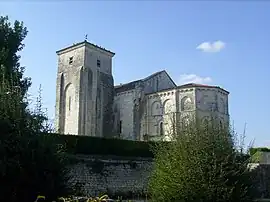 The St. Magdalene Church, Beurlay | |
Location of Beurlay | |
 Beurlay  Beurlay | |
| Coordinates: 45°51′40″N 0°50′09″W / 45.8611°N 0.8358°W | |
| Country | France |
| Region | Nouvelle-Aquitaine |
| Department | Charente-Maritime |
| Arrondissement | Saintes |
| Canton | Saint-Porchaire |
| Government | |
| • Mayor (2020–2026) | Gérard Gandauber[1] |
| Area 1 | 9.71 km2 (3.75 sq mi) |
| Population | 1,022 |
| • Density | 110/km2 (270/sq mi) |
| Time zone | UTC+01:00 (CET) |
| • Summer (DST) | UTC+02:00 (CEST) |
| INSEE/Postal code | 17045 /17250 |
| Elevation | 5–40 m (16–131 ft) |
| 1 French Land Register data, which excludes lakes, ponds, glaciers > 1 km2 (0.386 sq mi or 247 acres) and river estuaries. | |
Beurlay (French pronunciation: [bœʁlɛ]) is a commune in the French department of Charente-Maritime, in the administrative region of Nouvelle-Aquitaine (before 2015: Poitou-Charentes), France.
Beurlay is twinned with the village of Burley, Hampshire, UK.
It being known for the biscuit factory in the same name, established 1848 by the Barraud family, who produces the Galette Charentaise.
It is located about 17 km (10.5 mi) from Rochefort.
Population
|
|
See also
References
- ↑ "Répertoire national des élus: les maires". data.gouv.fr, Plateforme ouverte des données publiques françaises (in French). 2 December 2020.
- ↑ "Populations légales 2020". The National Institute of Statistics and Economic Studies. 29 December 2022.
External links
 Media related to Beurlay at Wikimedia Commons
This article is issued from Wikipedia. The text is licensed under Creative Commons - Attribution - Sharealike. Additional terms may apply for the media files.