Marennes-Hiers-Brouage | |
|---|---|
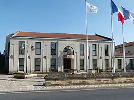 The town hall in Marennes | |
Location of Marennes-Hiers-Brouage | |
 Marennes-Hiers-Brouage  Marennes-Hiers-Brouage | |
| Coordinates: 45°49′21″N 1°06′19″W / 45.8225°N 1.1052°W | |
| Country | France |
| Region | Nouvelle-Aquitaine |
| Department | Charente-Maritime |
| Arrondissement | Rochefort |
| Canton | Marennes |
| Intercommunality | Bassin de Marennes |
| Government | |
| • Mayor (2020–2026) | Claude Balloteau[1] |
| Area 1 | 51.44 km2 (19.86 sq mi) |
| Population | 6,203 |
| • Density | 120/km2 (310/sq mi) |
| Time zone | UTC+01:00 (CET) |
| • Summer (DST) | UTC+02:00 (CEST) |
| INSEE/Postal code | 17219 /17320 |
| Elevation | 0–21 m (0–69 ft) |
| 1 French Land Register data, which excludes lakes, ponds, glaciers > 1 km2 (0.386 sq mi or 247 acres) and river estuaries. | |
Marennes-Hiers-Brouage (French pronunciation: [maʁɛn jɛʁs bʁuaʒ]) is a commune in the Charente-Maritime department in southwestern France. It was established on 1 January 2019 by merger of the former communes of Marennes (the seat) and Hiers-Brouage.[3]
Population
| Year | Pop. | ±% p.a. |
|---|---|---|
| 1968 | 4,962 | — |
| 1975 | 4,654 | −0.91% |
| 1982 | 5,025 | +1.10% |
| 1990 | 5,132 | +0.26% |
| 1999 | 5,157 | +0.05% |
| 2007 | 5,948 | +1.80% |
| 2012 | 6,264 | +1.04% |
| 2017 | 6,252 | −0.04% |
| Source: INSEE[4] | ||
See also
References
- ↑ "Répertoire national des élus: les maires" (in French). data.gouv.fr, Plateforme ouverte des données publiques françaises. 13 September 2022.
- ↑ "Populations légales 2020". The National Institute of Statistics and Economic Studies. 29 December 2022.
- ↑ Arrêté préfectoral 27 November 2018 (in French)
- ↑ Population en historique depuis 1968, INSEE
External links
 Media related to Marennes-Hiers-Brouage at Wikimedia Commons
This article is issued from Wikipedia. The text is licensed under Creative Commons - Attribution - Sharealike. Additional terms may apply for the media files.