Yvoy-le-Marron | |
|---|---|
Commune | |
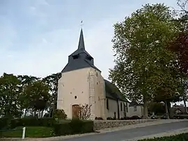 Church of Saint-Caprais | |
Location of Yvoy-le-Marron | |
 Yvoy-le-Marron  Yvoy-le-Marron | |
| Coordinates: 47°38′00″N 1°51′14″E / 47.6333°N 1.8539°E | |
| Country | France |
| Region | Centre-Val de Loire |
| Department | Loir-et-Cher |
| Arrondissement | Romorantin-Lanthenay |
| Canton | La Sologne |
| Intercommunality | Sologne des Étangs |
| Government | |
| • Mayor (2020–2026) | Daniel Lombardi[1] |
| Area 1 | 48.92 km2 (18.89 sq mi) |
| Population | 780 |
| • Density | 16/km2 (41/sq mi) |
| Demonym(s) | Capraisiens, Capraisiennes |
| Time zone | UTC+01:00 (CET) |
| • Summer (DST) | UTC+02:00 (CEST) |
| INSEE/Postal code | 41297 /41600 |
| Elevation | 94–138 m (308–453 ft) (avg. 127 m or 417 ft) |
| 1 French Land Register data, which excludes lakes, ponds, glaciers > 1 km2 (0.386 sq mi or 247 acres) and river estuaries. | |
Yvoy-le-Marron (French pronunciation: [ivwa lə maʁɔ̃]) is a commune in the Loir-et-Cher department in central France.
Population
| Year | Pop. | ±% p.a. |
|---|---|---|
| 1968 | 540 | — |
| 1975 | 544 | +0.11% |
| 1982 | 483 | −1.68% |
| 1990 | 494 | +0.28% |
| 1999 | 538 | +0.95% |
| 2007 | 603 | +1.44% |
| 2012 | 607 | +0.13% |
| 2017 | 728 | +3.70% |
| Source: INSEE[3] | ||
See also
References
- ↑ "Répertoire national des élus: les maires" (in French). data.gouv.fr, Plateforme ouverte des données publiques françaises. 13 September 2022.
- ↑ "Populations légales 2020". The National Institute of Statistics and Economic Studies. 29 December 2022.
- ↑ Population en historique depuis 1968, INSEE
Wikimedia Commons has media related to Yvoy-le-Marron.
This article is issued from Wikipedia. The text is licensed under Creative Commons - Attribution - Sharealike. Additional terms may apply for the media files.