La Chapelle-Vendômoise | |
|---|---|
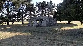 Dolmen de la Pierre Levée | |
Location of La Chapelle-Vendômoise | |
 La Chapelle-Vendômoise  La Chapelle-Vendômoise | |
| Coordinates: 47°40′18″N 1°14′24″E / 47.6717°N 1.24°E | |
| Country | France |
| Region | Centre-Val de Loire |
| Department | Loir-et-Cher |
| Arrondissement | Blois |
| Canton | Veuzain-sur-Loire |
| Intercommunality | CA Blois Agglopolys |
| Government | |
| • Mayor (2020–2026) | François Borde[1] |
| Area 1 | 13.07 km2 (5.05 sq mi) |
| Population | 800 |
| • Density | 61/km2 (160/sq mi) |
| Time zone | UTC+01:00 (CET) |
| • Summer (DST) | UTC+02:00 (CEST) |
| INSEE/Postal code | 41040 /41330 |
| Elevation | 87–131 m (285–430 ft) (avg. 117 m or 384 ft) |
| 1 French Land Register data, which excludes lakes, ponds, glaciers > 1 km2 (0.386 sq mi or 247 acres) and river estuaries. | |
La Chapelle-Vendômoise (French pronunciation: [la ʃapɛl vɑ̃domwaz]) is a commune in the Loir-et-Cher department in central France.[3]
Population
| Year | Pop. | ±% p.a. |
|---|---|---|
| 1968 | 421 | — |
| 1975 | 553 | +3.97% |
| 1982 | 623 | +1.72% |
| 1990 | 708 | +1.61% |
| 1999 | 744 | +0.55% |
| 2007 | 747 | +0.05% |
| 2012 | 715 | −0.87% |
| 2017 | 783 | +1.83% |
| Source: INSEE[4] | ||
See also
References
- ↑ "Répertoire national des élus: les maires". data.gouv.fr, Plateforme ouverte des données publiques françaises (in French). 2 December 2020.
- ↑ "Populations légales 2020". The National Institute of Statistics and Economic Studies. 29 December 2022.
- ↑ INSEE commune file, (in French)
- ↑ Population en historique depuis 1968, INSEE
Wikimedia Commons has media related to La Chapelle-Vendômoise.
This article is issued from Wikipedia. The text is licensed under Creative Commons - Attribution - Sharealike. Additional terms may apply for the media files.