Saint-Denis-sur-Loire | |
|---|---|
Commune | |
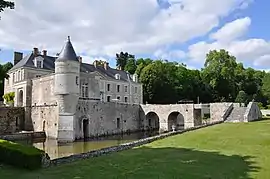 Castle of Saint-Denis-sur-Loire | |
Location of Saint-Denis-sur-Loire | |
 Saint-Denis-sur-Loire  Saint-Denis-sur-Loire | |
| Coordinates: 47°37′33″N 1°23′14″E / 47.6258°N 1.3872°E | |
| Country | France |
| Region | Centre-Val de Loire |
| Department | Loir-et-Cher |
| Arrondissement | Blois |
| Canton | Blois-2 |
| Intercommunality | CA Blois Agglopolys |
| Government | |
| • Mayor (2020–2026) | Patrick Menon[1] |
| Area 1 | 12.4 km2 (4.8 sq mi) |
| Population | 876 |
| • Density | 71/km2 (180/sq mi) |
| Time zone | UTC+01:00 (CET) |
| • Summer (DST) | UTC+02:00 (CEST) |
| INSEE/Postal code | 41206 /41000 |
| Elevation | 69–115 m (226–377 ft) (avg. 120 m or 390 ft) |
| 1 French Land Register data, which excludes lakes, ponds, glaciers > 1 km2 (0.386 sq mi or 247 acres) and river estuaries. | |
Saint-Denis-sur-Loire (French pronunciation: [sɛ̃ dəni syʁ lwaʁ], literally Saint-Denis on Loire) is a commune in the Loir-et-Cher department in Centre-Val de Loire, France.[3]
It is a suburb of Blois, 7 km northeast of the town, and lies on the river Loire, 63 km southwest of Orléans.
Population
| Year | Pop. | ±% p.a. |
|---|---|---|
| 1968 | 403 | — |
| 1975 | 498 | +3.07% |
| 1982 | 708 | +5.15% |
| 1990 | 907 | +3.14% |
| 1999 | 884 | −0.28% |
| 2007 | 859 | −0.36% |
| 2012 | 768 | −2.21% |
| 2017 | 837 | +1.74% |
| Source: INSEE[4] | ||
See also
References
- ↑ "Répertoire national des élus: les maires". data.gouv.fr, Plateforme ouverte des données publiques françaises (in French). 9 August 2021.
- ↑ "Populations légales 2020". The National Institute of Statistics and Economic Studies. 29 December 2022.
- ↑ INSEE commune file
- ↑ Population en historique depuis 1968, INSEE
Wikimedia Commons has media related to Saint-Denis-sur-Loire.
This article is issued from Wikipedia. The text is licensed under Creative Commons - Attribution - Sharealike. Additional terms may apply for the media files.