Têche | |
|---|---|
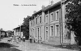 The town hall and school at the start of the 20th century | |
Location of Têche | |
 Têche  Têche | |
| Coordinates: 45°11′01″N 5°22′56″E / 45.1836°N 5.3822°E | |
| Country | France |
| Region | Auvergne-Rhône-Alpes |
| Department | Isère |
| Arrondissement | Grenoble |
| Canton | Le Sud Grésivaudan |
| Intercommunality | Saint-Marcellin Vercors Isère |
| Government | |
| • Mayor (2020–2026) | Philippe Charbonnel[1] |
| Area 1 | 5.03 km2 (1.94 sq mi) |
| Population | 582 |
| • Density | 120/km2 (300/sq mi) |
| Time zone | UTC+01:00 (CET) |
| • Summer (DST) | UTC+02:00 (CEST) |
| INSEE/Postal code | 38500 /38470 |
| Elevation | 162–411 m (531–1,348 ft) (avg. 259 m or 850 ft) |
| 1 French Land Register data, which excludes lakes, ponds, glaciers > 1 km2 (0.386 sq mi or 247 acres) and river estuaries. | |
Têche (French pronunciation: [tɛʃ]) is a commune in the Isère department in southeastern France.[3]
Population
| Year | Pop. | ±% p.a. |
|---|---|---|
| 1968 | 286 | — |
| 1975 | 301 | +0.73% |
| 1982 | 387 | +3.66% |
| 1990 | 484 | +2.84% |
| 1999 | 493 | +0.20% |
| 2009 | 549 | +1.08% |
| 2014 | 582 | +1.17% |
| 2020 | 582 | +0.00% |
| Source: INSEE[4] | ||
See also
References
- ↑ "Répertoire national des élus: les maires" (in French). data.gouv.fr, Plateforme ouverte des données publiques françaises. 13 September 2022.
- ↑ "Populations légales 2020". The National Institute of Statistics and Economic Studies. 29 December 2022.
- ↑ INSEE commune file
- ↑ Population en historique depuis 1968, INSEE
Wikimedia Commons has media related to Têche.
This article is issued from Wikipedia. The text is licensed under Creative Commons - Attribution - Sharealike. Additional terms may apply for the media files.