Le Sappey-en-Chartreuse | |
|---|---|
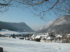 A general view of Le Sappey-en-Chartreuse in winter | |
Location of Le Sappey-en-Chartreuse | |
 Le Sappey-en-Chartreuse  Le Sappey-en-Chartreuse | |
| Coordinates: 45°15′48″N 5°46′44″E / 45.2633°N 5.7789°E | |
| Country | France |
| Region | Auvergne-Rhône-Alpes |
| Department | Isère |
| Arrondissement | Grenoble |
| Canton | Meylan |
| Intercommunality | Grenoble-Alpes Métropole |
| Government | |
| • Mayor (2020–2026) | Dominique Escaron[1] |
| Area 1 | 15.13 km2 (5.84 sq mi) |
| Population | 1,133 |
| • Density | 75/km2 (190/sq mi) |
| Time zone | UTC+01:00 (CET) |
| • Summer (DST) | UTC+02:00 (CEST) |
| INSEE/Postal code | 38471 /38700 |
| Elevation | 840–2,079 m (2,756–6,821 ft) (avg. 1,014 m or 3,327 ft) |
| 1 French Land Register data, which excludes lakes, ponds, glaciers > 1 km2 (0.386 sq mi or 247 acres) and river estuaries. | |
Le Sappey-en-Chartreuse is a commune in the Isère department in southeastern France.[3]
Population
| Year | Pop. | ±% p.a. |
|---|---|---|
| 1968 | 285 | — |
| 1975 | 371 | +3.84% |
| 1982 | 557 | +5.98% |
| 1990 | 762 | +4.00% |
| 1999 | 942 | +2.38% |
| 2009 | 1,069 | +1.27% |
| 2014 | 1,120 | +0.94% |
| 2020 | 1,133 | +0.19% |
| Source: INSEE[4] | ||
See also
References
- ↑ "Répertoire national des élus: les maires". data.gouv.fr, Plateforme ouverte des données publiques françaises (in French). 2 December 2020.
- ↑ "Populations légales 2020". The National Institute of Statistics and Economic Studies. 29 December 2022.
- ↑ INSEE commune file
- ↑ Population en historique depuis 1968, INSEE
Wikimedia Commons has media related to Le Sappey-en-Chartreuse.
This article is issued from Wikipedia. The text is licensed under Creative Commons - Attribution - Sharealike. Additional terms may apply for the media files.