Montcarra | |
|---|---|
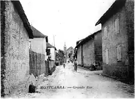 The main road in 1910 | |
Location of Montcarra | |
 Montcarra  Montcarra | |
| Coordinates: 45°36′50″N 5°23′31″E / 45.6139°N 5.3919°E | |
| Country | France |
| Region | Auvergne-Rhône-Alpes |
| Department | Isère |
| Arrondissement | La Tour-du-Pin |
| Canton | La Tour-du-Pin |
| Government | |
| • Mayor (2020–2026) | David Emeraud[1] |
| Area 1 | 4.9 km2 (1.9 sq mi) |
| Population | 588 |
| • Density | 120/km2 (310/sq mi) |
| Time zone | UTC+01:00 (CET) |
| • Summer (DST) | UTC+02:00 (CEST) |
| INSEE/Postal code | 38250 /38890 |
| Elevation | 309–452 m (1,014–1,483 ft) |
| 1 French Land Register data, which excludes lakes, ponds, glaciers > 1 km2 (0.386 sq mi or 247 acres) and river estuaries. | |
Montcarra (French pronunciation: [mɔ̃kaʁa]) is a commune in the Isère department in southeastern France.[3]
Population
| Year | Pop. | ±% p.a. |
|---|---|---|
| 1968 | 179 | — |
| 1975 | 189 | +0.78% |
| 1982 | 233 | +3.04% |
| 1990 | 288 | +2.68% |
| 1999 | 351 | +2.22% |
| 2009 | 465 | +2.85% |
| 2014 | 511 | +1.90% |
| 2020 | 588 | +2.37% |
| Source: INSEE[4] | ||
See also
References
- ↑ "Répertoire national des élus: les maires". data.gouv.fr, Plateforme ouverte des données publiques françaises (in French). 2 December 2020.
- ↑ "Populations légales 2020". The National Institute of Statistics and Economic Studies. 29 December 2022.
- ↑ INSEE commune file
- ↑ Population en historique depuis 1968, INSEE
Wikimedia Commons has media related to Montcarra.
This article is issued from Wikipedia. The text is licensed under Creative Commons - Attribution - Sharealike. Additional terms may apply for the media files.