Marillac-le-Franc | |
|---|---|
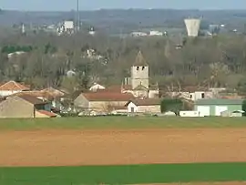 A general view of Marillac-le-Franc | |
Location of Marillac-le-Franc | |
 Marillac-le-Franc  Marillac-le-Franc | |
| Coordinates: 45°44′10″N 0°25′50″E / 45.7361°N 0.4306°E | |
| Country | France |
| Region | Nouvelle-Aquitaine |
| Department | Charente |
| Arrondissement | Angoulême |
| Canton | Val de Tardoire |
| Intercommunality | La Rochefoucauld - Porte du Périgord |
| Government | |
| • Mayor (2020–2026) | Pierre Bardoulat[1] |
| Area 1 | 14.49 km2 (5.59 sq mi) |
| Population | 824 |
| • Density | 57/km2 (150/sq mi) |
| Time zone | UTC+01:00 (CET) |
| • Summer (DST) | UTC+02:00 (CEST) |
| INSEE/Postal code | 16209 /16110 |
| Elevation | 84–203 m (276–666 ft) (avg. 100 m or 330 ft) |
| 1 French Land Register data, which excludes lakes, ponds, glaciers > 1 km2 (0.386 sq mi or 247 acres) and river estuaries. | |
Marillac-le-Franc (French pronunciation: [maʁijak lə fʁɑ̃]; Occitan: Marilhac) is a commune in the Charente department in southwestern France.
Population
| Year | Pop. | ±% p.a. |
|---|---|---|
| 1968 | 521 | — |
| 1975 | 599 | +2.01% |
| 1982 | 574 | −0.61% |
| 1990 | 626 | +1.09% |
| 1999 | 617 | −0.16% |
| 2009 | 739 | +1.82% |
| 2014 | 830 | +2.35% |
| 2020 | 824 | −0.12% |
| Source: INSEE[3] | ||
See also
References
- ↑ "Répertoire national des élus: les maires" (in French). data.gouv.fr, Plateforme ouverte des données publiques françaises. 13 September 2022.
- ↑ "Populations légales 2020". The National Institute of Statistics and Economic Studies. 29 December 2022.
- ↑ Population en historique depuis 1968, INSEE
Wikimedia Commons has media related to Marillac-le-Franc.
This article is issued from Wikipedia. The text is licensed under Creative Commons - Attribution - Sharealike. Additional terms may apply for the media files.