La Faye | |
|---|---|
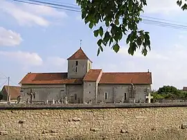 The church in La Faye | |
Location of La Faye | |
 La Faye  La Faye | |
| Coordinates: 46°01′16″N 0°08′51″E / 46.0211°N 0.1475°E | |
| Country | France |
| Region | Nouvelle-Aquitaine |
| Department | Charente |
| Arrondissement | Confolens |
| Canton | Charente-Nord |
| Intercommunality | Val de Charente |
| Government | |
| • Mayor (2020–2026) | Éric Cornuaud[1] |
| Area 1 | 13.44 km2 (5.19 sq mi) |
| Population | 572 |
| • Density | 43/km2 (110/sq mi) |
| Time zone | UTC+01:00 (CET) |
| • Summer (DST) | UTC+02:00 (CEST) |
| INSEE/Postal code | 16136 /16700 |
| Elevation | 104–149 m (341–489 ft) (avg. 134 m or 440 ft) |
| 1 French Land Register data, which excludes lakes, ponds, glaciers > 1 km2 (0.386 sq mi or 247 acres) and river estuaries. | |
La Faye is a commune in the Charente department in southwestern France.
Population
| Year | Pop. | ±% p.a. |
|---|---|---|
| 1968 | 490 | — |
| 1975 | 547 | +1.58% |
| 1982 | 519 | −0.75% |
| 1990 | 539 | +0.47% |
| 1999 | 568 | +0.58% |
| 2009 | 615 | +0.80% |
| 2014 | 639 | +0.77% |
| 2020 | 572 | −1.83% |
| Source: INSEE[3] | ||
See also
References
- ↑ "Répertoire national des élus: les maires" (in French). data.gouv.fr, Plateforme ouverte des données publiques françaises. 13 September 2022.
- ↑ "Populations légales 2020". The National Institute of Statistics and Economic Studies. 29 December 2022.
- ↑ Population en historique depuis 1968, INSEE
Wikimedia Commons has media related to La Faye.
This article is issued from Wikipedia. The text is licensed under Creative Commons - Attribution - Sharealike. Additional terms may apply for the media files.