Wasco State Airport | |||||||||||
|---|---|---|---|---|---|---|---|---|---|---|---|
 | |||||||||||
| Summary | |||||||||||
| Airport type | Public | ||||||||||
| Operator | Oregon Department of Aviation | ||||||||||
| Location | Wasco, Oregon | ||||||||||
| Elevation AMSL | 1,503 ft / 458 m | ||||||||||
| Coordinates | 45°35′22.0000″N 120°40′27.00″W / 45.589444444°N 120.6741667°W | ||||||||||
| Runways | |||||||||||
| |||||||||||
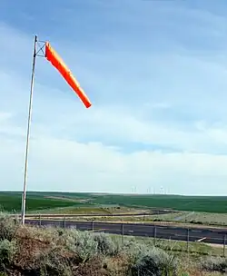
Wasco State Airport (FAA LID: 35S) is a public airport located one mile (1.6 km) east of Wasco in Sherman County, Oregon, United States.
External links
- Resources for this airport:
- FAA airport information for 35S
- AirNav airport information for 35S
- FlightAware airport information and live flight tracker
- SkyVector aeronautical chart for 35S
This article is issued from Wikipedia. The text is licensed under Creative Commons - Attribution - Sharealike. Additional terms may apply for the media files.