Saint-Lormel
Sant-Loheñvel | |
|---|---|
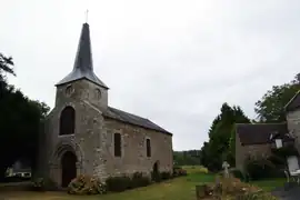 The old church of Saint-Lunaire, in Saint-Lormel | |
Location of Saint-Lormel | |
 Saint-Lormel 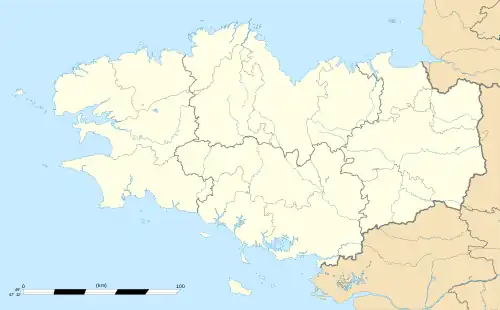 Saint-Lormel | |
| Coordinates: 48°32′48″N 2°13′42″W / 48.5467°N 2.2283°W | |
| Country | France |
| Region | Brittany |
| Department | Côtes-d'Armor |
| Arrondissement | Dinan |
| Canton | Plancoët |
| Intercommunality | Dinan Agglomération |
| Government | |
| • Mayor (2020–2026) | René Bouan[1] |
| Area 1 | 9.77 km2 (3.77 sq mi) |
| Population | 881 |
| • Density | 90/km2 (230/sq mi) |
| Time zone | UTC+01:00 (CET) |
| • Summer (DST) | UTC+02:00 (CEST) |
| INSEE/Postal code | 22311 /22130 |
| Elevation | 0–61 m (0–200 ft) |
| 1 French Land Register data, which excludes lakes, ponds, glaciers > 1 km2 (0.386 sq mi or 247 acres) and river estuaries. | |
Saint-Lormel (French pronunciation: [sɛ̃ lɔʁmɛl]; Breton: Sant-Loheñvel) is a commune in the Côtes-d'Armor department of Brittany in northwestern France.
Population
| Year | Pop. | ±% |
|---|---|---|
| 1962 | 729 | — |
| 1968 | 716 | −1.8% |
| 1975 | 736 | +2.8% |
| 1982 | 780 | +6.0% |
| 1990 | 787 | +0.9% |
| 1999 | 777 | −1.3% |
| 2008 | 887 | +14.2% |
See also
References
- ↑ "Répertoire national des élus: les maires". data.gouv.fr, Plateforme ouverte des données publiques françaises (in French). 9 August 2021.
- ↑ "Populations légales 2020". The National Institute of Statistics and Economic Studies. 29 December 2022.
- ↑ Fiche cours d'eau - L'Arguenon (J11-0300), Sandre; Service d'administration nationale des données et référentiels sur l'eau, retrieved 15 September 2021
External links
Wikimedia Commons has media related to Saint-Lormel.
- Base Mérimée: Search for heritage in the commune, Ministère français de la Culture. (in French)
This article is issued from Wikipedia. The text is licensed under Creative Commons - Attribution - Sharealike. Additional terms may apply for the media files.