31°10′N 83°26′W / 31.167°N 83.433°W
Cook County | |
|---|---|
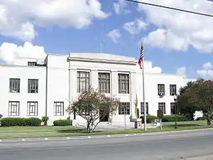 Cook County Courthouse in Adel | |
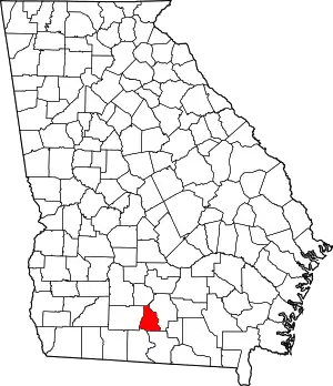 Location within the U.S. state of Georgia | |
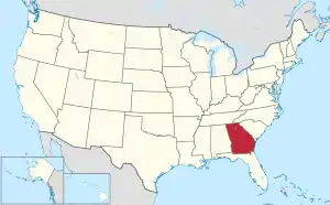 Georgia's location within the U.S. | |
| Coordinates: 31°10′00″N 83°26′00″W / 31.1667°N 83.4333°W | |
| Country | |
| State | |
| Founded | 1918 |
| Named for | Philip Cook |
| Seat | Adel |
| Largest city | Adel |
| Area | |
| • Total | 233 sq mi (600 km2) |
| • Land | 227 sq mi (590 km2) |
| • Water | 6.0 sq mi (16 km2) 2.6% |
| Population (2020) | |
| • Total | 17,229 |
| • Density | 76/sq mi (29/km2) |
| Time zone | UTC−5 (Eastern) |
| • Summer (DST) | UTC−4 (EDT) |
| Congressional district | 8th |
| Website | www |
Cook County is a county located in the south central portion of the U.S. state of Georgia. As of the 2020 census, the population was 17,229.[1] The county seat is Adel.[2] The constitutional amendment to create the county was proposed July 30, 1918, and ratified November 5, 1918. It is named for former Civil War general Philip Cook of the Confederate States Army.[3]
Reed Bingham State Park is in Cook County.
Geography
According to the U.S. Census Bureau, the county has a total area of 233 square miles (600 km2), of which 227 square miles (590 km2) is land and 6.0 square miles (16 km2) (2.6%) is water.[4]
The western half of Cook County, located roughly west of Interstate 75, is located in the Little River sub-basin of the Suwannee River basin. The eastern half of the county is located in the Withlacoochee River sub-basin of the same Suwannee River basin.[5]
Major highways
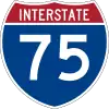 Interstate 75
 U.S. Route 41
 State Route 7
 State Route 37
 State Route 76
 State Route 401 (unsigned designation for I-75)
Adjacent counties
- Tift County (north)
- Berrien County (east)
- Lowndes County (southeast)
- Brooks County (southwest)
- Colquitt County (west)
Communities
Demographics
| Census | Pop. | Note | %± |
|---|---|---|---|
| 1920 | 11,180 | — | |
| 1930 | 11,311 | 1.2% | |
| 1940 | 11,919 | 5.4% | |
| 1950 | 12,201 | 2.4% | |
| 1960 | 11,822 | −3.1% | |
| 1970 | 12,129 | 2.6% | |
| 1980 | 13,490 | 11.2% | |
| 1990 | 13,456 | −0.3% | |
| 2000 | 15,771 | 17.2% | |
| 2010 | 17,212 | 9.1% | |
| 2020 | 17,229 | 0.1% | |
| U.S. Decennial Census[6] 1790-1960[7] 1900-1990[8] 1990-2000[9] 2010-2019[10] | |||
| Race | Num. | Perc. |
|---|---|---|
| White (non-Hispanic) | 10,658 | 61.86% |
| Black or African American (non-Hispanic) | 4,753 | 27.59% |
| Native American | 29 | 0.17% |
| Asian | 100 | 0.58% |
| Pacific Islander | 4 | 0.02% |
| Other/Mixed | 551 | 3.2% |
| Hispanic or Latino | 1,134 | 6.58% |
As of the 2020 United States census, there were 17,229 people, 6,217 households, and 4,243 families residing in the county.
Education
It is within the Cook County School District. It operates Cook County High School.
Politics
| Year | Republican | Democratic | Third party | |||
|---|---|---|---|---|---|---|
| No. | % | No. | % | No. | % | |
| 2020 | 4,900 | 69.63% | 2,059 | 29.26% | 78 | 1.11% |
| 2016 | 4,176 | 68.68% | 1,753 | 28.83% | 151 | 2.48% |
| 2012 | 3,935 | 65.14% | 2,042 | 33.80% | 64 | 1.06% |
| 2008 | 3,782 | 64.00% | 2,075 | 35.12% | 52 | 0.88% |
| 2004 | 3,065 | 63.56% | 1,733 | 35.94% | 24 | 0.50% |
| 2000 | 2,279 | 57.78% | 1,639 | 41.56% | 26 | 0.66% |
| 1996 | 1,354 | 39.74% | 1,780 | 52.25% | 273 | 8.01% |
| 1992 | 1,318 | 36.56% | 1,731 | 48.02% | 556 | 15.42% |
| 1988 | 1,555 | 55.69% | 1,226 | 43.91% | 11 | 0.39% |
| 1984 | 1,860 | 55.19% | 1,510 | 44.81% | 0 | 0.00% |
| 1980 | 1,188 | 32.25% | 2,461 | 66.80% | 35 | 0.95% |
| 1976 | 670 | 18.86% | 2,882 | 81.14% | 0 | 0.00% |
| 1972 | 2,135 | 80.26% | 525 | 19.74% | 0 | 0.00% |
| 1968 | 521 | 14.62% | 605 | 16.98% | 2,438 | 68.41% |
| 1964 | 2,058 | 60.62% | 1,337 | 39.38% | 0 | 0.00% |
| 1960 | 399 | 17.10% | 1,935 | 82.90% | 0 | 0.00% |
| 1956 | 245 | 10.45% | 2,100 | 89.55% | 0 | 0.00% |
| 1952 | 395 | 14.41% | 2,347 | 85.59% | 0 | 0.00% |
| 1948 | 123 | 7.81% | 1,192 | 75.73% | 259 | 16.45% |
| 1944 | 204 | 15.01% | 1,155 | 84.99% | 0 | 0.00% |
| 1940 | 143 | 13.19% | 941 | 86.81% | 0 | 0.00% |
| 1936 | 117 | 6.44% | 1,697 | 93.45% | 2 | 0.11% |
| 1932 | 25 | 1.74% | 1,408 | 97.78% | 7 | 0.49% |
| 1928 | 237 | 25.59% | 689 | 74.41% | 0 | 0.00% |
| 1924 | 44 | 7.57% | 502 | 86.40% | 35 | 6.02% |
| 1920 | 303 | 53.82% | 260 | 46.18% | 0 | 0.00% |
See also
References
- ↑ "Census - Geography Profile: Cook County, Georgia". United States Census Bureau. Retrieved December 26, 2022.
- ↑ "Find a County". National Association of Counties. Archived from the original on May 31, 2011. Retrieved June 7, 2011.
- ↑ Krakow, Kenneth K. (1975). Georgia Place-Names: Their History and Origins (PDF). Macon, GA: Winship Press. p. 51. ISBN 0-915430-00-2. Archived (PDF) from the original on July 10, 2003.
- ↑ "US Gazetteer files: 2010, 2000, and 1990". United States Census Bureau. February 12, 2011. Retrieved April 23, 2011.
- ↑ "Georgia Soil and Water Conservation Commission Interactive Mapping Experience". Georgia Soil and Water Conservation Commission. Retrieved November 27, 2015.
- ↑ "U.S. Decennial Census". United States Census Bureau. Retrieved June 20, 2014.
- ↑ "Historical Census Browser". University of Virginia Library. Retrieved June 20, 2014.
- ↑ "Population of Counties by Decennial Census: 1900 to 1990". United States Census Bureau. Retrieved June 20, 2014.
- ↑ "Census 2000 PHC-T-4. Ranking Tables for Counties: 1990 and 2000" (PDF). United States Census Bureau. Archived (PDF) from the original on March 27, 2010. Retrieved June 20, 2014.
- ↑ "State & County QuickFacts". United States Census Bureau. Archived from the original on June 7, 2011. Retrieved June 20, 2014.
- ↑ "Explore Census Data". data.census.gov. Retrieved December 18, 2021.
- ↑ Leip, David. "Dave Leip's Atlas of U.S. Presidential Elections". uselectionatlas.org. Retrieved March 19, 2018.
External links
- Official Site
- Cook County historical marker
Places adjacent to Cook County, Georgia | ||||||||||||||||
|---|---|---|---|---|---|---|---|---|---|---|---|---|---|---|---|---|
| ||||||||||||||||
Municipalities and communities of Cook County, Georgia, United States | ||
|---|---|---|
| City | Map of Georgia highlighting Cook County | |
| Towns | ||
| Unincorporated community | ||