Bacon County | |
|---|---|
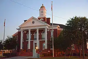 Bacon County Courthouse in Alma | |
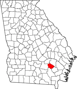 Location within the U.S. state of Georgia | |
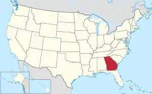 Georgia's location within the U.S. | |
| Coordinates: 31°34′N 82°27′W / 31.56°N 82.45°W | |
| Country | |
| State | |
| Founded | July 27, 1914 |
| Named for | Augustus Octavius Bacon |
| Seat | Alma |
| Largest city | Alma |
| Area | |
| • Total | 286 sq mi (740 km2) |
| • Land | 259 sq mi (670 km2) |
| • Water | 27 sq mi (70 km2) 9.5% |
| Population (2020) | |
| • Total | 11,140 |
| • Density | 43/sq mi (17/km2) |
| Time zone | UTC−5 (Eastern) |
| • Summer (DST) | UTC−4 (EDT) |
| Congressional district | 1st |
Bacon County is a county located in the southeastern part of the U.S. state of Georgia. As of the 2020 census, the population was 11,140.[1] The county seat is Alma.[2]
History
The constitutional amendment to create the county was proposed July 7, 1914, and ratified November 3, 1914. It is named after Augustus Bacon, a former United States Senator from Georgia.[3]
Geography
According to the U.S. Census Bureau, the county has a total area of 286 square miles (740 km2), of which 259 square miles (670 km2) are land and 27 square miles (70 km2) (9.5%) are covered by water.[4]
The majority and western portion of Bacon County is located in the Satilla River sub-basin of the St. Marys River-Satilla River basin. The entire eastern and half of the southeastern edge of the county is located in the Little Satilla River sub-basin of the same St. Marys-Satilla River basin.[5]
Major highways
Adjacent counties
- Appling County (northeast)
- Pierce County (east)
- Ware County (south)
- Coffee County (west)
- Jeff Davis County (northwest)
Communities
City
- Alma (county seat)
Unincorporated communities
Demographics
| Census | Pop. | Note | %± |
|---|---|---|---|
| 1920 | 6,460 | — | |
| 1930 | 7,055 | 9.2% | |
| 1940 | 8,096 | 14.8% | |
| 1950 | 8,940 | 10.4% | |
| 1960 | 8,359 | −6.5% | |
| 1970 | 8,233 | −1.5% | |
| 1980 | 9,379 | 13.9% | |
| 1990 | 9,566 | 2.0% | |
| 2000 | 10,103 | 5.6% | |
| 2010 | 11,096 | 9.8% | |
| 2020 | 11,140 | 0.4% | |
| U.S. Decennial Census[6] 1790-1960[7] 1900-1990[8] 1990-2000[9] 2010-2019[10] | |||
| Race | Num. | Perc. |
|---|---|---|
| White (non-Hispanic) | 8,103 | 72.74% |
| Black or African American (non-Hispanic) | 1,747 | 15.68% |
| Native American | 4 | 0.04% |
| Asian | 40 | 0.36% |
| Pacific Islander | 4 | 0.04% |
| Other/Mixed | 367 | 3.29% |
| Hispanic or Latino | 875 | 7.85% |
As of the 2020 United States census, there were 11,140 people, 3,874 households, and 2,706 families residing in the county.
Politics
| Year | Republican | Democratic | Third party | |||
|---|---|---|---|---|---|---|
| No. | % | No. | % | No. | % | |
| 2020 | 4,017 | 86.07% | 625 | 13.39% | 25 | 0.54% |
| 2016 | 3,364 | 83.49% | 608 | 15.09% | 57 | 1.41% |
| 2012 | 3,093 | 78.58% | 791 | 20.10% | 52 | 1.32% |
| 2008 | 3,089 | 78.36% | 817 | 20.73% | 36 | 0.91% |
| 2004 | 2,853 | 75.24% | 930 | 24.53% | 9 | 0.24% |
| 2000 | 2,010 | 67.11% | 956 | 31.92% | 29 | 0.97% |
| 1996 | 1,580 | 47.07% | 1,360 | 40.51% | 417 | 12.42% |
| 1992 | 1,301 | 39.01% | 1,423 | 42.67% | 611 | 18.32% |
| 1988 | 1,407 | 64.13% | 780 | 35.55% | 7 | 0.32% |
| 1984 | 1,778 | 63.77% | 1,010 | 36.23% | 0 | 0.00% |
| 1980 | 1,427 | 45.94% | 1,622 | 52.22% | 57 | 1.84% |
| 1976 | 594 | 19.87% | 2,395 | 80.13% | 0 | 0.00% |
| 1972 | 1,771 | 90.22% | 192 | 9.78% | 0 | 0.00% |
| 1968 | 586 | 20.93% | 279 | 9.96% | 1,935 | 69.11% |
| 1964 | 2,136 | 64.43% | 1,179 | 35.57% | 0 | 0.00% |
| 1960 | 579 | 33.14% | 1,168 | 66.86% | 0 | 0.00% |
| 1956 | 394 | 13.88% | 2,445 | 86.12% | 0 | 0.00% |
| 1952 | 543 | 26.42% | 1,512 | 73.58% | 0 | 0.00% |
| 1948 | 104 | 8.42% | 785 | 63.56% | 346 | 28.02% |
| 1944 | 220 | 22.38% | 763 | 77.62% | 0 | 0.00% |
| 1940 | 97 | 10.51% | 821 | 88.95% | 5 | 0.54% |
| 1936 | 62 | 6.26% | 929 | 93.74% | 0 | 0.00% |
| 1932 | 11 | 2.08% | 515 | 97.54% | 2 | 0.38% |
| 1928 | 203 | 39.96% | 305 | 60.04% | 0 | 0.00% |
| 1924 | 79 | 7.49% | 961 | 91.09% | 15 | 1.42% |
| 1920 | 219 | 41.63% | 307 | 58.37% | 0 | 0.00% |
| 1916 | 0 | 0.00% | 287 | 86.19% | 46 | 13.81% |
Education
See also
References
- ↑ "Census - Geography Profile: Bacon County, Georgia". United States Census Bureau. Retrieved December 26, 2022.
- ↑ "Find a County". National Association of Counties. Archived from the original on May 31, 2011. Retrieved June 7, 2011.
- ↑ "Bacon County Board of Tax Assessors". Bacon County Board of Tax Assessors. Retrieved February 11, 2023.
- ↑ "US Gazetteer files: 2010, 2000, and 1990". United States Census Bureau. February 12, 2011. Retrieved April 23, 2011.
- ↑ "Georgia Soil and Water Conservation Commission Interactive Mapping Experience". Georgia Soil and Water Conservation Commission. Archived from the original on October 3, 2018. Retrieved November 27, 2015.
- ↑ "U.S. Decennial Census". United States Census Bureau. Retrieved June 17, 2014.
- ↑ "Historical Census Browser". University of Virginia Library. Retrieved June 17, 2014.
- ↑ "Population of Counties by Decennial Census: 1900 to 1990". United States Census Bureau. Retrieved June 17, 2014.
- ↑ "Census 2000 PHC-T-4. Ranking Tables for Counties: 1990 and 2000" (PDF). United States Census Bureau. Archived (PDF) from the original on March 27, 2010. Retrieved June 17, 2014.
- ↑ "State & County QuickFacts". United States Census Bureau. Archived from the original on June 7, 2011. Retrieved June 17, 2014.
- ↑ "Explore Census Data". data.census.gov. Retrieved December 18, 2021.
- ↑ Leip, David. "Dave Leip's Atlas of U.S. Presidential Elections". uselectionatlas.org. Retrieved March 18, 2018.
External links
- Description at georgia.gov Archived May 15, 2016, at the Wayback Machine
- Bacon County historical marker
Places adjacent to Bacon County, Georgia | ||||||||||||||||
|---|---|---|---|---|---|---|---|---|---|---|---|---|---|---|---|---|
| ||||||||||||||||
Municipalities and communities of Bacon County, Georgia, United States | ||
|---|---|---|
| City | Map of Georgia highlighting Bacon County | |
| CDP | ||
| Unincorporated community | ||