Clinch County | |
|---|---|
 Clinch County Courthouse in Homerville | |
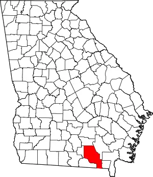 Location within the U.S. state of Georgia | |
 Georgia's location within the U.S. | |
| Coordinates: 30°55′N 82°42′W / 30.92°N 82.7°W | |
| Country | |
| State | |
| Founded | 1850 |
| Named for | Duncan Lamont Clinch |
| Seat | Homerville |
| Largest city | Homerville |
| Area | |
| • Total | 824 sq mi (2,130 km2) |
| • Land | 800 sq mi (2,000 km2) |
| • Water | 24 sq mi (60 km2) 2.9% |
| Population (2020) | |
| • Total | 6,749 |
| • Density | 8.4/sq mi (3.2/km2) |
| Time zone | UTC−5 (Eastern) |
| • Summer (DST) | UTC−4 (EDT) |
| Congressional district | 8th |
| Website | clinchcountyga |
Clinch County is a county located in the southeastern part of the U.S. state of Georgia. As of the 2020 census, the population was 6,749.[1] The county seat is Homerville.[2] The county was created on February 14, 1850, named in honor of Duncan Lamont Clinch.[3]
Geography
According to the U.S. Census Bureau, the county has a total area of 824 square miles (2,130 km2), of which 800 square miles (2,100 km2) is land and 24 square miles (62 km2) (2.9%) is water.[4] It is the fourth-largest county in Georgia by land area and third-largest by total area. Eastern and southeastern portions of the county lie within the Okefenokee Swamp and its federally protected areas.
The vast majority of Clinch County is located in the Upper Suwannee River sub-basin of the Suwannee River basin, with just a portion of the western and northwestern edge of the county, southwest and well northwest of Du Pont, located in the Alapaha River sub-basin of the same Suwannee River basin.[5]
Major highways
Adjacent counties
- Atkinson County (north)
- Ware County (east)
- Columbia County, Florida (south)
- Baker County, Florida (south)
- Echols County (southwest)
- Lanier County (west)
National protected area
Communities
Demographics
| Census | Pop. | Note | %± |
|---|---|---|---|
| 1850 | 637 | — | |
| 1860 | 3,063 | 380.8% | |
| 1870 | 3,945 | 28.8% | |
| 1880 | 4,138 | 4.9% | |
| 1890 | 6,652 | 60.8% | |
| 1900 | 8,732 | 31.3% | |
| 1910 | 8,424 | −3.5% | |
| 1920 | 7,984 | −5.2% | |
| 1930 | 7,015 | −12.1% | |
| 1940 | 6,437 | −8.2% | |
| 1950 | 6,007 | −6.7% | |
| 1960 | 6,545 | 9.0% | |
| 1970 | 6,405 | −2.1% | |
| 1980 | 6,660 | 4.0% | |
| 1990 | 6,160 | −7.5% | |
| 2000 | 6,878 | 11.7% | |
| 2010 | 6,798 | −1.2% | |
| 2020 | 6,749 | −0.7% | |
| U.S. Decennial Census[6] 1790-1960[7] 1900-1990[8] 1990-2000[9] 2010-2019[10] | |||
| Race | Num. | Perc. |
|---|---|---|
| White (non-Hispanic) | 4,256 | 63.06% |
| Black or African American (non-Hispanic) | 1,950 | 28.89% |
| Native American | 30 | 0.44% |
| Asian | 22 | 0.33% |
| Pacific Islander | 7 | 0.1% |
| Other/Mixed | 231 | 3.42% |
| Hispanic or Latino | 253 | 3.75% |
As of the 2020 United States census, there were 6,749 people, 2,477 households, and 1,639 families residing in the county.
Education
Politics
| Year | Republican | Democratic | Third party | |||
|---|---|---|---|---|---|---|
| No. | % | No. | % | No. | % | |
| 2020 | 2,105 | 73.55% | 744 | 26.00% | 13 | 0.45% |
| 2016 | 1,727 | 70.09% | 686 | 27.84% | 51 | 2.07% |
| 2012 | 1,598 | 64.57% | 852 | 34.42% | 25 | 1.01% |
| 2008 | 1,678 | 62.10% | 989 | 36.60% | 35 | 1.30% |
| 2004 | 1,501 | 66.18% | 750 | 33.07% | 17 | 0.75% |
| 2000 | 1,091 | 56.56% | 816 | 42.30% | 22 | 1.14% |
| 1996 | 789 | 40.42% | 973 | 49.85% | 190 | 9.73% |
| 1992 | 790 | 43.00% | 759 | 41.32% | 288 | 15.68% |
| 1988 | 863 | 58.91% | 594 | 40.55% | 8 | 0.55% |
| 1984 | 862 | 57.97% | 625 | 42.03% | 0 | 0.00% |
| 1980 | 513 | 27.52% | 1,325 | 71.08% | 26 | 1.39% |
| 1976 | 383 | 21.31% | 1,414 | 78.69% | 0 | 0.00% |
| 1972 | 1,127 | 82.50% | 239 | 17.50% | 0 | 0.00% |
| 1968 | 304 | 17.08% | 334 | 18.76% | 1,142 | 64.16% |
| 1964 | 1,084 | 60.56% | 706 | 39.44% | 0 | 0.00% |
| 1960 | 397 | 30.66% | 898 | 69.34% | 0 | 0.00% |
| 1956 | 518 | 24.73% | 1,577 | 75.27% | 0 | 0.00% |
| 1952 | 350 | 23.06% | 1,168 | 76.94% | 0 | 0.00% |
| 1948 | 168 | 9.63% | 1,283 | 73.57% | 293 | 16.80% |
| 1944 | 64 | 9.91% | 582 | 90.09% | 0 | 0.00% |
| 1940 | 63 | 5.67% | 1,049 | 94.33% | 0 | 0.00% |
| 1936 | 71 | 6.60% | 1,002 | 93.21% | 2 | 0.19% |
| 1932 | 11 | 2.32% | 461 | 97.26% | 2 | 0.42% |
| 1928 | 143 | 16.63% | 717 | 83.37% | 0 | 0.00% |
| 1924 | 13 | 4.91% | 235 | 88.68% | 17 | 6.42% |
| 1920 | 77 | 20.75% | 294 | 79.25% | 0 | 0.00% |
| 1916 | 8 | 1.84% | 374 | 85.98% | 53 | 12.18% |
| 1912 | 9 | 2.65% | 283 | 83.24% | 48 | 14.12% |
Notable people
- Ossie Davis, actor
- Matthew Lintz, actor
- Iris Faircloth Blitch, politician, only woman to sign Southern Manifesto
- W. Benjamin Gibbs, politician
- William Chester Lankford, politician
- Jonathan Smith, football player
See also
References
- ↑ "Census - Geography Profile: Clinch County, Georgia". United States Census Bureau. Retrieved December 26, 2022.
- ↑ "Find a County". National Association of Counties. Archived from the original on May 31, 2011. Retrieved June 7, 2011.
- ↑ Krakow, Kenneth K. (1975). Georgia Place-Names: Their History and Origins (PDF). Macon, GA: Winship Press. p. 46. ISBN 0-915430-00-2. Archived (PDF) from the original on July 10, 2003.
- ↑ "US Gazetteer files: 2010, 2000, and 1990". United States Census Bureau. February 12, 2011. Retrieved April 23, 2011.
- ↑ "Georgia Soil and Water Conservation Commission Interactive Mapping Experience". Georgia Soil and Water Conservation Commission. Retrieved November 27, 2015.
- ↑ "U.S. Decennial Census". United States Census Bureau. Retrieved June 20, 2014.
- ↑ "Historical Census Browser". University of Virginia Library. Retrieved June 20, 2014.
- ↑ "Population of Counties by Decennial Census: 1900 to 1990". United States Census Bureau. Retrieved June 20, 2014.
- ↑ "Census 2000 PHC-T-4. Ranking Tables for Counties: 1990 and 2000" (PDF). United States Census Bureau. Archived (PDF) from the original on March 27, 2010. Retrieved June 20, 2014.
- ↑ "State & County QuickFacts". United States Census Bureau. Archived from the original on February 27, 2016. Retrieved June 20, 2014.
- ↑ "Explore Census Data". data.census.gov. Retrieved December 17, 2021.
- ↑ Leip, David. "Dave Leip's Atlas of U.S. Presidential Elections". uselectionatlas.org. Retrieved March 19, 2018.
External links
- The Clinch County News - Local newspaper
- Okefenokee National Wildlife Refuge U.S. Fish and Wildlife Service
- Clinch County historical marker
- Bethany Baptist Church historical marker
Places adjacent to Clinch County, Georgia | ||||||||||||||||
|---|---|---|---|---|---|---|---|---|---|---|---|---|---|---|---|---|
| ||||||||||||||||
Municipalities and communities of Clinch County, Georgia, United States | ||
|---|---|---|
| Cities | Map of Georgia highlighting Clinch County | |
| Towns | ||
| CDP | ||
| Other unincorporated communities | ||