Werndorf | |
|---|---|
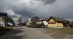 Street in Werndorf | |
 Coat of arms | |
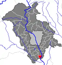 Location within Graz-Umgebung district | |
 Werndorf Location within Austria | |
| Coordinates: 46°55′16″N 15°28′52″E / 46.92111°N 15.48111°E | |
| Country | Austria |
| State | Styria |
| District | Graz-Umgebung |
| Government | |
| • Mayor | Willibald Rohrer (SPÖ) |
| Area | |
| • Total | 6.23 km2 (2.41 sq mi) |
| Elevation | 309 m (1,014 ft) |
| Population (2018-01-01)[2] | |
| • Total | 2,365 |
| • Density | 380/km2 (980/sq mi) |
| Time zone | UTC+1 (CET) |
| • Summer (DST) | UTC+2 (CEST) |
| Postal code | 8402 |
| Area code | 03135 |
| Vehicle registration | GU |
| Website | www.werndorf. steiermark.at |
Werndorf is a municipality in the district of Graz-Umgebung in the Austrian state of Styria.
Population
| Year | Pop. | ±% |
|---|---|---|
| 1869 | 336 | — |
| 1880 | 356 | +6.0% |
| 1890 | 340 | −4.5% |
| 1900 | 357 | +5.0% |
| 1910 | 381 | +6.7% |
| 1923 | 556 | +45.9% |
| 1934 | 598 | +7.6% |
| 1939 | 624 | +4.3% |
| 1951 | 738 | +18.3% |
| 1961 | 1,021 | +38.3% |
| 1971 | 1,446 | +41.6% |
| 1981 | 1,555 | +7.5% |
| 1991 | 1,632 | +5.0% |
| 2001 | 2,007 | +23.0% |
| 2008 | 2,116 | +5.4% |
References
- ↑ "Dauersiedlungsraum der Gemeinden Politischen Bezirke und Bundesländer - Gebietsstand 1.1.2018". Statistics Austria. Retrieved 10 March 2019.
- ↑ "Einwohnerzahl 1.1.2018 nach Gemeinden mit Status, Gebietsstand 1.1.2018". Statistics Austria. Retrieved 9 March 2019.
This article is issued from Wikipedia. The text is licensed under Creative Commons - Attribution - Sharealike. Additional terms may apply for the media files.