Nestelbach bei Graz | |
|---|---|
 View of Nestelbach | |
 Coat of arms | |
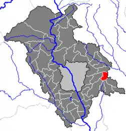 Location within Graz-Umgebung district | |
 Nestelbach bei Graz Location within Austria | |
| Coordinates: 47°03′44″N 15°36′30″E / 47.06222°N 15.60833°E | |
| Country | Austria |
| State | Styria |
| District | Graz-Umgebung |
| Government | |
| • Mayor | Franz Roth (Nestelbach) (ÖVP) |
| Area | |
| • Total | 27.19 km2 (10.50 sq mi) |
| Elevation | 450 m (1,480 ft) |
| Population (2018-01-01)[2] | |
| • Total | 2,648 |
| • Density | 97/km2 (250/sq mi) |
| Time zone | UTC+1 (CET) |
| • Summer (DST) | UTC+2 (CEST) |
| Postal code | 8302 |
| Area code | 03133 |
| Vehicle registration | GU |
| Website | www.nestelbach-graz.at |
Nestelbach bei Graz is a municipality in the district of Graz-Umgebung in the Austrian state of Styria.
Population
| Year | Pop. | ±% |
|---|---|---|
| 1869 | 612 | — |
| 1880 | 658 | +7.5% |
| 1890 | 662 | +0.6% |
| 1900 | 665 | +0.5% |
| 1910 | 638 | −4.1% |
| 1923 | 707 | +10.8% |
| 1934 | 754 | +6.6% |
| 1939 | 722 | −4.2% |
| 1951 | 834 | +15.5% |
| 1961 | 841 | +0.8% |
| 1971 | 819 | −2.6% |
| 1981 | 839 | +2.4% |
| 1991 | 1,049 | +25.0% |
| 2001 | 1,132 | +7.9% |
| 2011 | 1,900 | +67.8% |
References
- ↑ "Dauersiedlungsraum der Gemeinden Politischen Bezirke und Bundesländer - Gebietsstand 1.1.2018". Statistics Austria. Retrieved 10 March 2019.
- ↑ "Einwohnerzahl 1.1.2018 nach Gemeinden mit Status, Gebietsstand 1.1.2018". Statistics Austria. Retrieved 9 March 2019.
This article is issued from Wikipedia. The text is licensed under Creative Commons - Attribution - Sharealike. Additional terms may apply for the media files.