Wall Township | |
|---|---|
 Location in Ford County | |
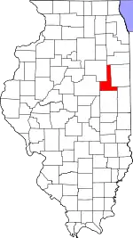 Ford County's location in Illinois | |
| Coordinates: 40°31′25″N 88°10′56″W / 40.52361°N 88.18222°W | |
| Country | United States |
| State | Illinois |
| County | Ford |
| Established | June 12, 1867 |
| Area | |
| • Total | 36.72 sq mi (95.1 km2) |
| • Land | 36.68 sq mi (95.0 km2) |
| • Water | 0.04 sq mi (0.1 km2) 0.11% |
| Elevation | 771 ft (235 m) |
| Population (2010) | |
| • Estimate (2016)[1] | 200 |
| • Density | 5.7/sq mi (2.2/km2) |
| Time zone | UTC-6 (CST) |
| • Summer (DST) | UTC-5 (CDT) |
| ZIP codes | 60948, 60952, 60957 |
| FIPS code | 17-053-78474 |
Wall Township is one of twelve townships in Ford County, Illinois, USA. As of the 2010 census, its population was 209 and it contained 82 housing units.[2] The township was formed from Patton Township on June 12, 1867.
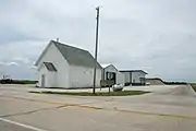
Township building
Geography
According to the 2010 census, the township has a total area of 36.72 square miles (95.1 km2), of which 36.68 square miles (95.0 km2) (or 99.89%) is land and 0.04 square miles (0.10 km2) (or 0.11%) is water.[2]
Airports and landing strips
- Beherns Airport
Demographics
| Census | Pop. | Note | %± |
|---|---|---|---|
| 2016 (est.) | 200 | [1] | |
| U.S. Decennial Census[3] | |||
School districts
- Gibson City-Melvin-Sibley Community Unit School District 5
- Paxton-Buckley-Loda Community Unit School District 10
Political districts
- Illinois' 15th congressional district
- State House District 105
- State Senate District 53
References
- "Wall Township, Ford County, Illinois". Geographic Names Information System. United States Geological Survey, United States Department of the Interior. Retrieved January 16, 2010.
- United States Census Bureau 2007 TIGER/Line Shapefiles
- United States National Atlas
- 1 2 "Population and Housing Unit Estimates". Retrieved June 9, 2017.
- 1 2 "Population, Housing Units, Area, and Density: 2010 - County -- County Subdivision and Place -- 2010 Census Summary File 1". United States Census. Archived from the original on February 12, 2020. Retrieved May 28, 2013.
- ↑ "Census of Population and Housing". Census.gov. Retrieved June 4, 2016.
External links
Places adjacent to Wall Township, Ford County, Illinois | |
|---|---|
Municipalities and communities of Ford County, Illinois, United States | ||
|---|---|---|
| Cities | Map of Illinois highlighting Ford County | |
| Villages | ||
| Townships | ||
| Unincorporated communities | ||
| Footnotes | ‡This populated place also has portions in an adjacent county or counties | |
This article is issued from Wikipedia. The text is licensed under Creative Commons - Attribution - Sharealike. Additional terms may apply for the media files.