Drummer Township | |
|---|---|
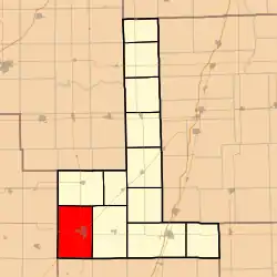 Location in Ford County | |
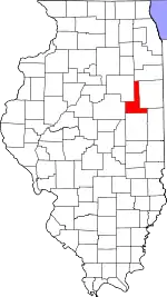 Ford County's location in Illinois | |
| Coordinates: 40°27′52″N 88°24′16″W / 40.46444°N 88.40444°W | |
| Country | United States |
| State | Illinois |
| County | Ford |
| Established | March 1, 1869 |
| Area | |
| • Total | 53.66 sq mi (139.0 km2) |
| • Land | 53.47 sq mi (138.5 km2) |
| • Water | 0.18 sq mi (0.5 km2) 0.34% |
| Elevation | 745 ft (227 m) |
| Population (2010) | |
| • Estimate (2016)[1] | 3,959 |
| • Density | 75.2/sq mi (29.0/km2) |
| Time zone | UTC-6 (CST) |
| • Summer (DST) | UTC-5 (CDT) |
| ZIP codes | 60936, 61845 |
| FIPS code | 17-053-20799 |
Drummer Township is one of twelve townships in Ford County, Illinois, USA. As of the 2020 census, its population was 4,046 and, as of the 2010 census, it contained 1,829 housing units.[2]
History
The township was formed from a portion of Dix Township (originally named Drummer Grove Township) on March 1, 1869. Drummer Township is named after a hunting dog called Drummer, who died while chasing a deer and was buried in what became known as Drummer Grove.[3][4]
Geography
According to the 2010 census, the township has a total area of 53.66 square miles (139.0 km2), of which 53.47 square miles (138.5 km2) (or 99.65%) is land and 0.18 square miles (0.47 km2) (or 0.34%) is water.[2]
Cities, towns, villages
Extinct towns
- Derby
- Garber
- Harpster
- Proctor
Cemeteries
The township contains Drummer Township Cemetery.
Major highways
Airports and landing strips
- Gibson Community Hospital Heliport
- Wright Airport
Demographics
| Census | Pop. | Note | %± |
|---|---|---|---|
| 2016 (est.) | 3,959 | [1] | |
| U.S. Decennial Census[5] | |||
School districts
- Gibson City-Melvin-Sibley Community Unit School District 5
Political districts
- Illinois' 15th congressional district
- State House District 105
- State Senate District 53
References
- "Drummer Township, Ford County, Illinois". Geographic Names Information System. United States Geological Survey, United States Department of the Interior. Retrieved January 16, 2010.
- United States Census Bureau 2007 TIGER/Line Shapefiles
- United States National Atlas
- 1 2 "Population and Housing Unit Estimates". Retrieved June 9, 2017.
- 1 2 "Population, Housing Units, Area, and Density: 2010 - County -- County Subdivision and Place -- 2010 Census Summary File 1". United States Census. Archived from the original on February 12, 2020. Retrieved May 28, 2013.
- ↑ Callary, Edward (September 29, 2008). Place Names of Illinois. University of Illinois Press. p. 98. ISBN 978-0-252-09070-7.
- ↑ Gardner, E. A. 1908. History of Ford County, Illinois, from Its Earliest Settlement to 1908. Chicago: Clarke, p. 117.
- ↑ "Census of Population and Housing". Census.gov. Retrieved June 4, 2016.
External links
Places adjacent to Drummer Township, Ford County, Illinois | |
|---|---|
Municipalities and communities of Ford County, Illinois, United States | ||
|---|---|---|
| Cities | Map of Illinois highlighting Ford County | |
| Villages | ||
| Townships | ||
| Unincorporated communities | ||
| Footnotes | ‡This populated place also has portions in an adjacent county or counties | |
This article is issued from Wikipedia. The text is licensed under Creative Commons - Attribution - Sharealike. Additional terms may apply for the media files.