Unterweitersdorf | |
|---|---|
 | |
 Coat of arms | |
 Unterweitersdorf Location within Austria | |
| Coordinates: 48°22′0″N 14°28′0″E / 48.36667°N 14.46667°E | |
| Country | Austria |
| State | Upper Austria |
| District | Freistadt |
| Government | |
| • Mayor | Wilhelm Wurm (SPÖ) |
| Area | |
| • Total | 11.41 km2 (4.41 sq mi) |
| Elevation | 333 m (1,093 ft) |
| Population (2018-01-01)[2] | |
| • Total | 2,082 |
| • Density | 180/km2 (470/sq mi) |
| Time zone | UTC+1 (CET) |
| • Summer (DST) | UTC+2 (CEST) |
| Postal code | 4213 |
| Area code | 07235 |
| Vehicle registration | FR |
| Website | www.unterweitersdorf.at |
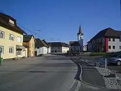
Unterweitersdorf is a municipality in the district of Freistadt in the Austrian state of Upper Austria.
Population
| Year | Pop. | ±% |
|---|---|---|
| 1869 | 629 | — |
| 1880 | 635 | +1.0% |
| 1890 | 653 | +2.8% |
| 1900 | 649 | −0.6% |
| 1910 | 682 | +5.1% |
| 1923 | 662 | −2.9% |
| 1934 | 651 | −1.7% |
| 1939 | 625 | −4.0% |
| 1951 | 617 | −1.3% |
| 1961 | 768 | +24.5% |
| 1971 | 893 | +16.3% |
| 1981 | 1,170 | +31.0% |
| 1991 | 1,415 | +20.9% |
| 2001 | 1,704 | +20.4% |
References
- ↑ "Dauersiedlungsraum der Gemeinden Politischen Bezirke und Bundesländer - Gebietsstand 1.1.2018". Statistics Austria. Retrieved 10 March 2019.
- ↑ "Einwohnerzahl 1.1.2018 nach Gemeinden mit Status, Gebietsstand 1.1.2018". Statistics Austria. Retrieved 9 March 2019.
Wikimedia Commons has media related to Unterweitersdorf.
This article is issued from Wikipedia. The text is licensed under Creative Commons - Attribution - Sharealike. Additional terms may apply for the media files.