Serrouville | |
|---|---|
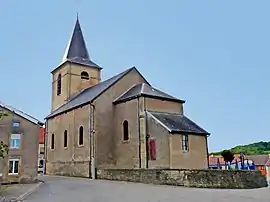 The church in Serrouville | |
 Coat of arms | |
Location of Serrouville | |
 Serrouville 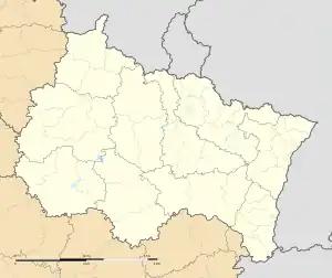 Serrouville | |
| Coordinates: 49°23′58″N 5°53′19″E / 49.3994°N 5.8886°E | |
| Country | France |
| Region | Grand Est |
| Department | Meurthe-et-Moselle |
| Arrondissement | Briey |
| Canton | Villerupt |
| Intercommunality | Cœur du Pays-Haut |
| Government | |
| • Mayor (2020–2026) | Patrice Picart[1] |
| Area 1 | 15.57 km2 (6.01 sq mi) |
| Population | 657 |
| • Density | 42/km2 (110/sq mi) |
| Time zone | UTC+01:00 (CET) |
| • Summer (DST) | UTC+02:00 (CEST) |
| INSEE/Postal code | 54504 /54560 |
| Elevation | 280–398 m (919–1,306 ft) (avg. 358 m or 1,175 ft) |
| 1 French Land Register data, which excludes lakes, ponds, glaciers > 1 km2 (0.386 sq mi or 247 acres) and river estuaries. | |
Serrouville (French pronunciation: [seʁuvil]; Luxembourgish: Sorsweller) is a commune in the Meurthe-et-Moselle department in north-eastern France.
Population
| Year | Pop. | ±% p.a. |
|---|---|---|
| 1968 | 479 | — |
| 1975 | 449 | −0.92% |
| 1982 | 408 | −1.36% |
| 1990 | 472 | +1.84% |
| 1999 | 525 | +1.19% |
| 2009 | 614 | +1.58% |
| 2014 | 720 | +3.24% |
| 2020 | 657 | −1.51% |
| Source: INSEE[3] | ||
See also
References
- ↑ "Répertoire national des élus: les maires". data.gouv.fr, Plateforme ouverte des données publiques françaises (in French). 9 August 2021.
- ↑ "Populations légales 2020". The National Institute of Statistics and Economic Studies. 29 December 2022.
- ↑ en historique depuis 1968, INSEE
Wikimedia Commons has media related to Serrouville.
This article is issued from Wikipedia. The text is licensed under Creative Commons - Attribution - Sharealike. Additional terms may apply for the media files.