Allain | |
|---|---|
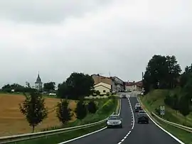 A general view of Allain | |
.svg.png.webp) Coat of arms | |
Location of Allain | |
 Allain 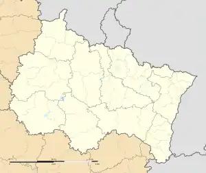 Allain | |
| Coordinates: 48°33′02″N 5°54′41″E / 48.5506°N 5.9114°E | |
| Country | France |
| Region | Grand Est |
| Department | Meurthe-et-Moselle |
| Arrondissement | Toul |
| Canton | Meine au Saintois |
| Intercommunality | Pays de Colombey et Sud Toulois |
| Government | |
| • Mayor (2020–2026) | Emeline Magnier-Caretti[1] |
| Area 1 | 16.48 km2 (6.36 sq mi) |
| Population | 470 |
| • Density | 29/km2 (74/sq mi) |
| Time zone | UTC+01:00 (CET) |
| • Summer (DST) | UTC+02:00 (CEST) |
| INSEE/Postal code | 54008 /54170 |
| Elevation | 259–381 m (850–1,250 ft) (avg. 305 m or 1,001 ft) |
| 1 French Land Register data, which excludes lakes, ponds, glaciers > 1 km2 (0.386 sq mi or 247 acres) and river estuaries. | |
Allain (French pronunciation: [alɛ̃]) is a commune in the Meurthe-et-Moselle department in northeastern France.
Population
Inhabitants are called Allainois.
| Year | Pop. | ±% p.a. |
|---|---|---|
| 1968 | 274 | — |
| 1975 | 254 | −1.08% |
| 1982 | 274 | +1.09% |
| 1990 | 353 | +3.22% |
| 1999 | 387 | +1.03% |
| 2007 | 461 | +2.21% |
| 2012 | 464 | +0.13% |
| 2017 | 478 | +0.60% |
| Source: INSEE[3] | ||
See also
References
- ↑ "Répertoire national des élus: les maires". data.gouv.fr, Plateforme ouverte des données publiques françaises (in French). 9 August 2021.
- ↑ "Populations légales 2020". The National Institute of Statistics and Economic Studies. 29 December 2022.
- ↑ Population en historique depuis 1968, INSEE
Wikimedia Commons has media related to Allain.
This article is issued from Wikipedia. The text is licensed under Creative Commons - Attribution - Sharealike. Additional terms may apply for the media files.