Sainte-Feyre | |
|---|---|
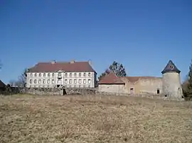 Chateau | |
Location of Sainte-Feyre | |
 Sainte-Feyre  Sainte-Feyre | |
| Coordinates: 46°08′20″N 1°54′57″E / 46.1389°N 1.9158°E | |
| Country | France |
| Region | Nouvelle-Aquitaine |
| Department | Creuse |
| Arrondissement | Guéret |
| Canton | Guéret-1 |
| Intercommunality | CA Grand Guéret |
| Government | |
| • Mayor (2020–2026) | Franck Réjaud[1] |
| Area 1 | 29.99 km2 (11.58 sq mi) |
| Population | 2,493 |
| • Density | 83/km2 (220/sq mi) |
| Time zone | UTC+01:00 (CET) |
| • Summer (DST) | UTC+02:00 (CEST) |
| INSEE/Postal code | 23193 /23000 |
| Elevation | 310–662 m (1,017–2,172 ft) |
| 1 French Land Register data, which excludes lakes, ponds, glaciers > 1 km2 (0.386 sq mi or 247 acres) and river estuaries. | |
Sainte-Feyre (French pronunciation: [sɛ̃t fɛʁ]; Occitan: Sent Afeiran) is a commune in the Creuse department in central France.
Population
|
| ||||||||||||||||||||||||||||||||||||||||||||||||||||||||||||||||||||||||||||||||||||||||||||||||||||||||||||||||||
| Source: EHESS[3] and INSEE (1968-2017)[4] | |||||||||||||||||||||||||||||||||||||||||||||||||||||||||||||||||||||||||||||||||||||||||||||||||||||||||||||||||||
See also
References
- ↑ "Répertoire national des élus: les maires". data.gouv.fr, Plateforme ouverte des données publiques françaises (in French). 9 August 2021.
- ↑ "Populations légales 2020". The National Institute of Statistics and Economic Studies. 29 December 2022.
- ↑ Des villages de Cassini aux communes d'aujourd'hui: Commune data sheet Sainte-Feyre, EHESS (in French).
- ↑ Population en historique depuis 1968, INSEE
Wikimedia Commons has media related to Sainte-Feyre.
This article is issued from Wikipedia. The text is licensed under Creative Commons - Attribution - Sharealike. Additional terms may apply for the media files.