Saint-Victurnien | |
|---|---|
 | |
.svg.png.webp) Coat of arms | |
Location of Saint-Victurnien | |
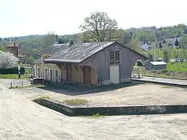
 Saint-Victurnien  Saint-Victurnien | |
| Coordinates: 45°52′42″N 1°00′51″E / 45.8783°N 1.0142°E | |
| Country | France |
| Region | Nouvelle-Aquitaine |
| Department | Haute-Vienne |
| Arrondissement | Rochechouart |
| Canton | Saint-Junien |
| Government | |
| • Mayor (2020–2026) | Jean Duchambon[1] |
| Area 1 | 21.04 km2 (8.12 sq mi) |
| Population | 1,764 |
| • Density | 84/km2 (220/sq mi) |
| Time zone | UTC+01:00 (CET) |
| • Summer (DST) | UTC+02:00 (CEST) |
| INSEE/Postal code | 87185 /87420 |
| Elevation | 172–323 m (564–1,060 ft) |
| 1 French Land Register data, which excludes lakes, ponds, glaciers > 1 km2 (0.386 sq mi or 247 acres) and river estuaries. | |
Saint-Victurnien (French pronunciation: [sɛ̃ viktyʁnjɛ̃]; Occitan: Sent Vertunian) is a commune in the Haute-Vienne department in the Nouvelle-Aquitaine region in west-central France. Its inhabitants are called Saint-Victurniauds.
The village is the only one between Saint-Junien and Aixe-sur-Vienne which extends over both banks of the river Vienne. It is located 10 km east of Saint-Junien and 20 km west of Limoges.
See also
References
- ↑ "Répertoire national des élus: les maires". data.gouv.fr, Plateforme ouverte des données publiques françaises (in French). 2 December 2020.
- ↑ "Populations légales 2020". The National Institute of Statistics and Economic Studies. 29 December 2022.
Wikimedia Commons has media related to Saint-Victurnien.
This article is issued from Wikipedia. The text is licensed under Creative Commons - Attribution - Sharealike. Additional terms may apply for the media files.