Saint-Auvent | |
|---|---|
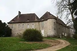 The Chateau of Saint-Auvent | |
 Coat of arms | |
Location of Saint-Auvent | |
 Saint-Auvent  Saint-Auvent | |
| Coordinates: 45°48′23″N 0°55′57″E / 45.8064°N 0.93250°E | |
| Country | France |
| Region | Nouvelle-Aquitaine |
| Department | Haute-Vienne |
| Arrondissement | Rochechouart |
| Canton | Rochechouart |
| Government | |
| • Mayor (2020–2026) | Bruno Grancoing[1] |
| Area 1 | 33.46 km2 (12.92 sq mi) |
| Population | 958 |
| • Density | 29/km2 (74/sq mi) |
| Time zone | UTC+01:00 (CET) |
| • Summer (DST) | UTC+02:00 (CEST) |
| INSEE/Postal code | 87135 /87310 |
| Elevation | 194–348 m (636–1,142 ft) |
| 1 French Land Register data, which excludes lakes, ponds, glaciers > 1 km2 (0.386 sq mi or 247 acres) and river estuaries. | |
Saint-Auvent (French pronunciation: [sɛ̃.t‿ovɑ̃]; Occitan: Sent Auvenç) is a commune in the Haute-Vienne department in the Nouvelle-Aquitaine region in west-central France.
Inhabitants are known as Auventais.
See also
References
- ↑ "Répertoire national des élus: les maires". data.gouv.fr, Plateforme ouverte des données publiques françaises (in French). 2 December 2020.
- ↑ "Populations légales 2020". The National Institute of Statistics and Economic Studies. 29 December 2022.
Wikimedia Commons has media related to Saint-Auvent.
This article is issued from Wikipedia. The text is licensed under Creative Commons - Attribution - Sharealike. Additional terms may apply for the media files.