Saint-Pierre-de-Mons | |
|---|---|
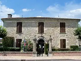 Town hall | |
Location of Saint-Pierre-de-Mons | |
 Saint-Pierre-de-Mons  Saint-Pierre-de-Mons | |
| Coordinates: 44°33′10″N 0°13′10″W / 44.5528°N 0.2194°W | |
| Country | France |
| Region | Nouvelle-Aquitaine |
| Department | Gironde |
| Arrondissement | Langon |
| Canton | Le Sud-Gironde |
| Government | |
| • Mayor (2020–2026) | Patrick Labayle[1] |
| Area 1 | 9.27 km2 (3.58 sq mi) |
| Population | 1,236 |
| • Density | 130/km2 (350/sq mi) |
| Time zone | UTC+01:00 (CET) |
| • Summer (DST) | UTC+02:00 (CEST) |
| INSEE/Postal code | 33465 /33210 |
| Elevation | 2–55 m (6.6–180.4 ft) (avg. 34 m or 112 ft) |
| 1 French Land Register data, which excludes lakes, ponds, glaciers > 1 km2 (0.386 sq mi or 247 acres) and river estuaries. | |
Saint-Pierre-de-Mons is a commune in the Gironde department in Nouvelle-Aquitaine in southwestern France.
Population
| Year | Pop. | ±% |
|---|---|---|
| 1962 | 606 | — |
| 1968 | 636 | +5.0% |
| 1975 | 585 | −8.0% |
| 1982 | 712 | +21.7% |
| 1990 | 799 | +12.2% |
| 1999 | 813 | +1.8% |
| 2008 | 1,050 | +29.2% |
See also
References
- ↑ "Répertoire national des élus: les maires". data.gouv.fr, Plateforme ouverte des données publiques françaises (in French). 2 December 2020.
- ↑ "Populations légales 2020". The National Institute of Statistics and Economic Studies. 29 December 2022.
Wikimedia Commons has media related to Saint-Pierre-de-Mons.
This article is issued from Wikipedia. The text is licensed under Creative Commons - Attribution - Sharealike. Additional terms may apply for the media files.