Saint-Antoine-du-Queyret | |
|---|---|
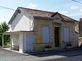 Town hall | |
Location of Saint-Antoine-du-Queyret | |
 Saint-Antoine-du-Queyret  Saint-Antoine-du-Queyret | |
| Coordinates: 44°45′50″N 0°00′38″E / 44.7639°N 0.0106°E | |
| Country | France |
| Region | Nouvelle-Aquitaine |
| Department | Gironde |
| Arrondissement | Langon |
| Canton | Le Réolais et Les Bastides |
| Government | |
| • Mayor (2020–2026) | Daniel Aubert[1] |
| Area 1 | 6.85 km2 (2.64 sq mi) |
| Population | 55 |
| • Density | 8.0/km2 (21/sq mi) |
| Time zone | UTC+01:00 (CET) |
| • Summer (DST) | UTC+02:00 (CEST) |
| INSEE/Postal code | 33372 /33790 |
| Elevation | 40–122 m (131–400 ft) (avg. 125 m or 410 ft) |
| 1 French Land Register data, which excludes lakes, ponds, glaciers > 1 km2 (0.386 sq mi or 247 acres) and river estuaries. | |
Saint-Antoine-du-Queyret (French pronunciation: [sɛ̃.t‿ɑ̃twan dy keʁɛ]; Occitan: Sent Antòni dau Cairet) is a commune in the Gironde department in Nouvelle-Aquitaine in southwestern France.
Population
| Year | Pop. | ±% |
|---|---|---|
| 1962 | 86 | — |
| 1968 | 122 | +41.9% |
| 1975 | 88 | −27.9% |
| 1982 | 100 | +13.6% |
| 1990 | 92 | −8.0% |
| 1999 | 77 | −16.3% |
| 2008 | 92 | +19.5% |
See also
References
- ↑ "Répertoire national des élus: les maires". data.gouv.fr, Plateforme ouverte des données publiques françaises (in French). 2 December 2020.
- ↑ "Populations légales 2020". The National Institute of Statistics and Economic Studies. 29 December 2022.
Wikimedia Commons has media related to Saint-Antoine-du-Queyret.
This article is issued from Wikipedia. The text is licensed under Creative Commons - Attribution - Sharealike. Additional terms may apply for the media files.