Saint-Désiré | |
|---|---|
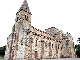 The church in Saint-Désiré | |
Location of Saint-Désiré | |
 Saint-Désiré  Saint-Désiré | |
| Coordinates: 46°29′54″N 2°25′57″E / 46.4983°N 2.4325°E | |
| Country | France |
| Region | Auvergne-Rhône-Alpes |
| Department | Allier |
| Arrondissement | Montluçon |
| Canton | Huriel |
| Intercommunality | Pays d'Huriel |
| Government | |
| • Mayor (2020–2026) | Nadège Vermez[1] |
| Area 1 | 41.89 km2 (16.17 sq mi) |
| Population | 441 |
| • Density | 11/km2 (27/sq mi) |
| Time zone | UTC+01:00 (CET) |
| • Summer (DST) | UTC+02:00 (CEST) |
| INSEE/Postal code | 03225 /03370 |
| Elevation | 193–400 m (633–1,312 ft) (avg. 328 m or 1,076 ft) |
| 1 French Land Register data, which excludes lakes, ponds, glaciers > 1 km2 (0.386 sq mi or 247 acres) and river estuaries. | |
Saint-Désiré (French pronunciation: [sɛ̃ deziʁe]; Occitan: Sant Desirat) is a commune in the Allier department in Auvergne-Rhône-Alpes in central France.
Population
| Year | Pop. | ±% |
|---|---|---|
| 1800 | 500 | — |
| 1900 | 1,400 | +180.0% |
| 1940 | 1,000 | −28.6% |
| 1962 | 650 | −35.0% |
| 1968 | 731 | +12.5% |
| 1975 | 555 | −24.1% |
| 1982 | 498 | −10.3% |
| 1990 | 442 | −11.2% |
| 1999 | 455 | +2.9% |
| 2008 | 470 | +3.3% |
| 2013 | 433 | −7.9% |
| 2015 | 434 | +0.2% |
| Source: INSEE (1968–2015) | ||
See also
References
- ↑ "Répertoire national des élus: les maires" (in French). data.gouv.fr, Plateforme ouverte des données publiques françaises. 13 September 2022.
- ↑ "Populations légales 2020". The National Institute of Statistics and Economic Studies. 29 December 2022.
External links
Wikimedia Commons has media related to Saint-Désiré.
This article is issued from Wikipedia. The text is licensed under Creative Commons - Attribution - Sharealike. Additional terms may apply for the media files.