Saint-André-Lachamp | |
|---|---|
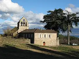 The church in Saint-André-Lachamp | |
Location of Saint-André-Lachamp | |
 Saint-André-Lachamp  Saint-André-Lachamp | |
| Coordinates: 44°30′21″N 4°09′51″E / 44.5058°N 4.1642°E | |
| Country | France |
| Region | Auvergne-Rhône-Alpes |
| Department | Ardèche |
| Arrondissement | Largentière |
| Canton | Les Cévennes ardéchoises |
| Intercommunality | Pays Beaume Drobie |
| Government | |
| • Mayor (2020–2026) | Luc Parmentier[1] |
| Area 1 | 17.09 km2 (6.60 sq mi) |
| Population | 153 |
| • Density | 9.0/km2 (23/sq mi) |
| Time zone | UTC+01:00 (CET) |
| • Summer (DST) | UTC+02:00 (CEST) |
| INSEE/Postal code | 07213 /07230 |
| Elevation | 220–882 m (722–2,894 ft) (avg. 750 m or 2,460 ft) |
| 1 French Land Register data, which excludes lakes, ponds, glaciers > 1 km2 (0.386 sq mi or 247 acres) and river estuaries. | |
Saint-André-Lachamp (French pronunciation: [sɛ̃.t‿ɑ̃dʁe laʃɑ̃]; Occitan: Sant Andrieu de la Chalm) is a commune in the Ardèche department in southern France.
Population
| Year | Pop. | ±% p.a. |
|---|---|---|
| 1968 | 171 | — |
| 1975 | 150 | −1.85% |
| 1982 | 148 | −0.19% |
| 1990 | 157 | +0.74% |
| 1999 | 122 | −2.76% |
| 2007 | 120 | −0.21% |
| 2012 | 147 | +4.14% |
| 2017 | 154 | +0.93% |
| Source: INSEE[3] | ||
See also
References
- ↑ "Répertoire national des élus: les maires". data.gouv.fr, Plateforme ouverte des données publiques françaises (in French). 9 August 2021.
- ↑ "Populations légales 2020". The National Institute of Statistics and Economic Studies. 29 December 2022.
- ↑ Population en historique depuis 1968, INSEE
Wikimedia Commons has media related to Saint-André-Lachamp.
This article is issued from Wikipedia. The text is licensed under Creative Commons - Attribution - Sharealike. Additional terms may apply for the media files.