Rouperroux | |
|---|---|
 | |
Location of Rouperroux | |
 Rouperroux  Rouperroux | |
| Coordinates: 48°32′55″N 0°05′03″W / 48.5486°N 0.0842°W | |
| Country | France |
| Region | Normandy |
| Department | Orne |
| Arrondissement | Alençon |
| Canton | Magny-le-Désert |
| Intercommunality | Pays fertois et Bocage carrougien |
| Government | |
| • Mayor (2020–2026) | Roland Sellos[1] |
| Area 1 | 9.78 km2 (3.78 sq mi) |
| Population | 191 |
| • Density | 20/km2 (51/sq mi) |
| Time zone | UTC+01:00 (CET) |
| • Summer (DST) | UTC+02:00 (CEST) |
| INSEE/Postal code | 61357 /61320 |
| Elevation | 239–399 m (784–1,309 ft) (avg. 280 m or 920 ft) |
| 1 French Land Register data, which excludes lakes, ponds, glaciers > 1 km2 (0.386 sq mi or 247 acres) and river estuaries. | |
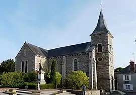
Rouperroux (French pronunciation: [ʁupɛʁu] ⓘ) is a commune in the Orne department in north-western France.
Notable buildings and places
National heritage sites
- Markers of Forêt d'Écouves a set of 80 markers positioned in teh 18th centuary that mark the boundaries of the forest, they were registered as a Monument historique in 1987.[3]
See also
References
- ↑ "Répertoire national des élus: les maires". data.gouv.fr, Plateforme ouverte des données publiques françaises (in French). 2 December 2020.
- ↑ "Populations légales 2020". The National Institute of Statistics and Economic Studies. 29 December 2022.
- ↑ "80 bornes de la forêt d'Ecouves (également sur communes de Le Bouillon, La Chapelle-près-Sées, La Ferrière-Béchet, Fontenai-les-Louvets, La Lande-de-Goult, Radon, Rouperroux, Saint-Didier-sous-Ecouves, Saint-Gervais-du-Perron, Tanville et Vingt-Hanap..." monumentum.fr.
Wikimedia Commons has media related to Rouperroux.
This article is issued from Wikipedia. The text is licensed under Creative Commons - Attribution - Sharealike. Additional terms may apply for the media files.