Banvou | |
|---|---|
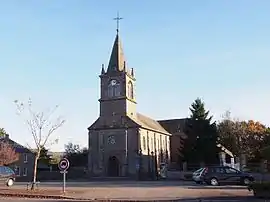 The church in Banvou | |
Location of Banvou | |
 Banvou  Banvou | |
| Coordinates: 48°39′57″N 0°33′06″W / 48.6658°N 0.5517°W | |
| Country | France |
| Region | Normandy |
| Department | Orne |
| Arrondissement | Argentan |
| Canton | La Ferté-Macé |
| Intercommunality | CA Flers Agglo |
| Government | |
| • Mayor (2020–2026) | Jean-Louis Pellerin[1] |
| Area 1 | 12.98 km2 (5.01 sq mi) |
| Population | 610 |
| • Density | 47/km2 (120/sq mi) |
| Time zone | UTC+01:00 (CET) |
| • Summer (DST) | UTC+02:00 (CEST) |
| INSEE/Postal code | 61024 /61450 |
| Elevation | 173–259 m (568–850 ft) (avg. 187 m or 614 ft) |
| 1 French Land Register data, which excludes lakes, ponds, glaciers > 1 km2 (0.386 sq mi or 247 acres) and river estuaries. | |
Banvou (French pronunciation: [bɑ̃vu] ⓘ) is a commune in the Orne department in northwestern France.
Geography
The commune is made up of the following collection of villages and hamlets, Mesnil Clou, La Rousselière, Pic Louvette, Meslé, L'Être Amiard, Le Pont, Le Plessis, La Lande, La Ribardière, La Gaudinière and Banvou.[3]
It is 1,300 hectares (5.0 sq mi) in size.[4] The highest point in the commune is 226 metres (741 ft).[4]
The Halouze and the Varenne are the two rivers, running through this commune.[4]
Neighbouring communes[3] | |
|---|---|
Population
| Year | Pop. | ±% |
|---|---|---|
| 1962 | 535 | — |
| 1968 | 488 | −8.8% |
| 1975 | 436 | −10.7% |
| 1982 | 418 | −4.1% |
| 1990 | 441 | +5.5% |
| 1999 | 456 | +3.4% |
| 2006 | 586 | +28.5% |
| 2008 | 619 | +5.6% |
See also
References
- ↑ "Répertoire national des élus: les maires". data.gouv.fr, Plateforme ouverte des données publiques françaises (in French). 9 August 2021.
- ↑ "Populations légales 2020". The National Institute of Statistics and Economic Studies. 29 December 2022.
- 1 2 "Banvou · 61450, France". Banvou · 61450, France.
- 1 2 3 "Mairie de Banvou et sa commune (61450)". Annuaire-Mairie. 26 October 2023.
Wikimedia Commons has media related to Banvou.
This article is issued from Wikipedia. The text is licensed under Creative Commons - Attribution - Sharealike. Additional terms may apply for the media files.