| Ross Glacier | |
|---|---|
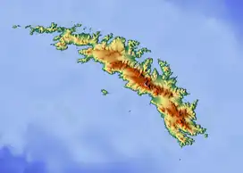 Location of Ross Glacier in South Georgia | |
| Location | South Georgia |
| Coordinates | 54°33′S 36°6′W / 54.550°S 36.100°W |
| Length | 6 nmi (11 km; 7 mi) |
| Thickness | unknown |
| Terminus | Royal Bay |
| Status | unknown |
Ross Glacier (54°33′S 36°6′W / 54.550°S 36.100°W) is a glacier 6 miles (10 km) long, flowing east from the juncture of Allardyce and Salvesen Ranges to Little Moltke Harbour, Royal Bay, on the north coast of South Georgia.[1] First mapped by the German group of the International Polar Year Investigations, 1882–83, and named for Sir James Clark Ross.[2]
See also
References
- ↑ Bicheno, Hugh (2006) Razor's Edge: The Unofficial History of the Falklands War. London. Weidenfeld & Nicolson. ISBN 978-0-7538-2186-2
- ↑ "Ross Glacier, Antarctica". Geographical Names. Retrieved 23 January 2018.
![]() This article incorporates public domain material from "Ross Glacier". Geographic Names Information System. United States Geological Survey.
This article incorporates public domain material from "Ross Glacier". Geographic Names Information System. United States Geological Survey.
Capital: King Edward Point | |||||||
| General | |||||||
| Settlements / Whaling stations | |||||||
| South Georgia islands | |||||||
| South Sandwich Islands |
| ||||||
| Seamounts | |||||||
| Landmarks |
| ||||||
This article is issued from Wikipedia. The text is licensed under Creative Commons - Attribution - Sharealike. Additional terms may apply for the media files.