| Rosanova Glacier | |
|---|---|
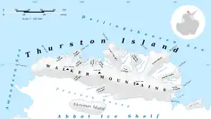 Map of Thurston Island | |
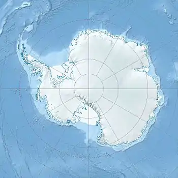 Location of Rosanova Glacier in Antarctica | |
| Location | Ellsworth Land |
| Coordinates | 73°15′00″S 97°55′00″W / 73.25000°S 97.91667°W / -73.25000; -97.91667 |
| Length | 8 nautical miles (15 km; 9.2 mi) |
| Thickness | unknown |
| Terminus | Abbot Ice Shelf |
| Status | unknown |
Rosanova Glacier (73°15′S 97°55′W / 73.250°S 97.917°W / -73.250; -97.917) is a glacier about 8 nautical miles (15 km; 9.2 mi) long flowing north from King Peninsula into the Abbot Ice Shelf. Named by Advisory Committee on Antarctic Names (US-ACAN) after Christine E. Rosanova, United States Geological Survey (USGS), Flagstaff, AZ; specialist in the use of satellite imagery for geological and glaciological studies from the early 1990s to 2002; a pioneer in the use of imagery for glacier velocity measurements.
See also
References
 This article incorporates public domain material from "Rosanova Glacier". Geographic Names Information System. United States Geological Survey.
| Types | |||||||
|---|---|---|---|---|---|---|---|
| Anatomy | |||||||
| Processes | |||||||
| Measurements | |||||||
| Volcanic relations | |||||||
| Landforms |
| ||||||
| |||||||
This article is issued from Wikipedia. The text is licensed under Creative Commons - Attribution - Sharealike. Additional terms may apply for the media files.