The Eritrea Portal
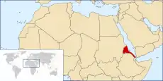
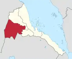
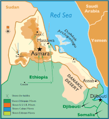
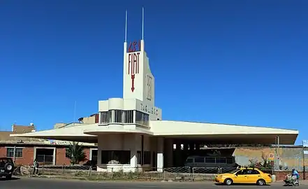
Eritrea (/ˌɛrɪˈtriːə/ ⓘ ERR-ih-TREE-ə or /-ˈtreɪ-/ -TRAY-; Tigrinya: ኤርትራ, romanized: Ertra, pronounced [ʔer(ɨ)trä] ⓘ), officially the State of Eritrea, is a country in the Horn of Africa region of Eastern Africa, with its capital and largest city at Asmara. It is bordered by Ethiopia in the south, Sudan in the west, and Djibouti in the southeast. The northeastern and eastern parts of Eritrea have an extensive coastline along the Red Sea. The nation has a total area of approximately 117,600 km2 (45,406 sq mi), and includes the Dahlak Archipelago and several of the Hanish Islands. Human remains found in Eritrea have been dated to 1 million years old and anthropological research indicates that the area may contain significant records related to the evolution of humans. The Kingdom of Aksum, covering much of modern-day Eritrea and northern Ethiopia, was established during the first or second century AD. It adopted Christianity around the middle of the fourth century. Beginning in the 12th century, the Ethiopian Zagwe and Solomonid dynasties held sway to a fluctuating extent over the entire plateau and the Red Sea coast. Eritrea's central highlands, known as Midri-Bahri ("Land of the Sea"), were the northern frontier region of the Ethiopian kingdoms and were ruled by a governor titled the Bahr Negash ("lord of the sea"). In the 16th century, the Ottomans occupied the Eritrean coastline. Beginning in 1882–1885, Italian troops systematically spread out from Massawa toward the highland, eventually resulting in the formation of the colony of Italian Eritrea in 1889. After World War II, Eritrea was administered by the British Military Administration until 1952. Following the UN General Assembly decision in 1952, Eritrea would govern itself with a local Eritrean parliament, but for foreign affairs and defense, it would enter into a federal status with Ethiopia for ten years. However, in 1962, the government of Ethiopia annulled the Eritrean parliament and formally annexed Eritrea. The Eritrean secessionist movement organised the Eritrean Liberation Front in 1961 and fought the Eritrean War of Independence until Eritrea gained de facto independence in 1991. Eritrea gained de jure independence in 1993 after an independence referendum. Contemporary Eritrea is a multi-ethnic country with nine recognised ethnic groups. Nine different languages are spoken by the nine recognised ethnic groups, the most widely spoken language being Tigrinya, the others being Tigre, Saho, Kunama, Nara, Afar, Beja, Bilen and Arabic. Tigrinya, Arabic, and English serve as the three working languages. Most residents speak languages from the Afroasiatic family, either of the Ethiopian Semitic languages or Cushitic branches. Among these communities, the Tigrinyas make up about 50% of the population, with the Tigre people constituting around 30% of inhabitants. In addition, there are several Nilo-Saharan-speaking Nilotic ethnic groups. Most people in the country adhere to Christianity or Islam, with a small minority adhering to traditional faiths. (Full article...) Selected article -Gash-Barka (Tigrinya: ጋሽ-ባርካ, Italian: Regione di Gash-Barka) is an administrative region of Eritrea. It is situated in the south-west of the country, bordering the Anseba region to the north, and the Maekel (Central) and Debub (Southern) regions to the east; the country of Sudan lies to the west and Ethiopia to the south. The capital of Gash-Barka is Barentu. Other towns include Agordat (the former capital), Molki, Sebderat and Teseney. As of 2005, the region had a population of 708,800 compared to a population of 625,100 in 2001. The net growth rate was 11.81 per cent. The total area of the province was 33,200 km2 and the density was 21.35 persons per km2., making up roughly one-third of Eritrea. The region is dubbed as the "breadbasket" of the country as it is rich in agriculture. The region is also rich in marble, and other important minerals, including gold. In Ougaro, there are some old mineshafts and machinery from the days when the Italians mined gold there. (Full article...)Selected picture -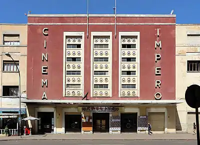 The Cinema Impero is an Art Deco-style cinema in Asmara, the capital of Eritrea. It was built in 1937 by the colonial authorities in Italian Eritrea.
Did you know -
CategoriesCategory puzzle Select [►] to view subcategories
Eritrea Eritrea-related lists Eritrean culture Economy of Eritrea Education in Eritrea Environment of Eritrea Geography of Eritrea Government of Eritrea Health in Eritrea History of Eritrea Organisations based in Eritrea Eritrean people Politics of Eritrea Society of Eritrea Eritrea stubs Related portalsWikiProjects
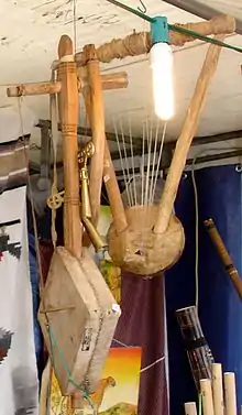
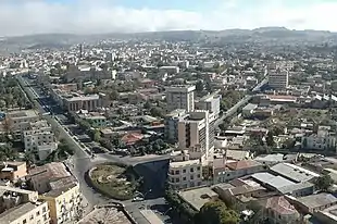
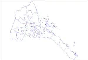
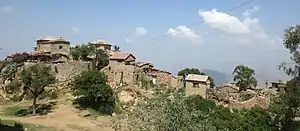
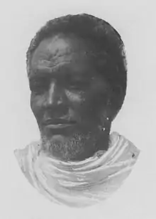
General images -
Topics in Eritrea
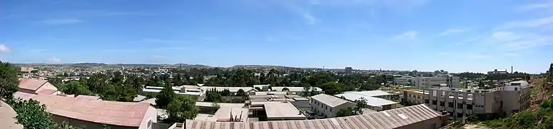
Selected panorama -Associated WikimediaThe following Wikimedia Foundation sister projects provide more on this subject:
SourcesDiscover Wikipedia using portals
| ||||||||||||||||||||||||||||||||||||||||||||||||||||||||||||||||||||||||
.svg.png.webp)


.jpg.webp)
_crowned.svg.png.webp)
.jpg.webp)

.jpg.webp)