North Fork Kentucky River is a river in Kentucky in the United States.[1] It is a fork of the Kentucky River. It is nearly 125 miles (201 km) long.
Course
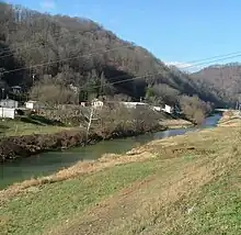
It rises on the northwest side of Pine Mountain, in the Appalachians of extreme southeastern Kentucky, in eastern Letcher County near the Virginia state line in Payne Gap, near the intersection of US 23 and US 119. It flows generally northwest, in a winding course through the mountainous Cumberland Plateau, past Whitesburg, Hazard and Jackson.
Tributaries and other locations
Its major tributaries are:
- Big Creek (Perry, Kentucky), whose further tributaries and locations are in its article
- Lotts Creek (Perry, Kentucky), whose further tributaries and locations are in its article
- Troublesome Creek (North Fork Kentucky River), whose further tributaries and locations are in its article
It receives Rockhouse Creek at Blackey near its source. Approximately 8 miles (13 km) southeast of Hazard, it receives the Carr Fork. Three miles upstream from its confluence with the South Fork, it receives the Middle Fork. It joins the South Fork to form the Kentucky River at Beattyville.
See also
Cross-reference
Sources
- Hodge, James Michael (1918). Coals of the North Fork of Kentucky River in Perry and Portions of Breathitt and Knott Counties. Reports of the Kentucky Geological Survey 4th series 1912–1918. Vol. 3. Frankfort, Kentucky: The State Journal Company. (Coals of the North Fork of Kentucky River in Perry and Portions of Breathitt and Knott Counties at the Internet Archive)
- Rennick, Robert M. (2000). "Perry County — Post Offices". County Histories of Kentucky. No. 273. Morehead State University.
Further reading
Municipalities and communities of Perry County, Kentucky, United States | ||
|---|---|---|
| Cities | 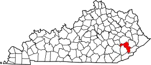 Location of Perry County, Kentucky | |
| CDPs | ||
| Other unincorporated communities |
| |
| Ghost town | ||
| Former mining towns | ||
| Post offices | ||