37°17′2″N 83°11′15″W / 37.28389°N 83.18750°W Lotts Creek is a stream in Perry County, Kentucky in the United States.[1] It a tributary of the North Fork Kentucky River that joins it at Darfork 3 miles (4.8 km) downstream of Hazard at an altitude of 820 feet (250 m).[2][1] It is 8.5 miles (13.7 km) long from its mouth to where it splits into the Young (previously Youngs) and Big (previously Kelly) Forks.[2][3]
The most likely source of the name "Lotts" is a William Harrison Lott of Clark County, however there is contradictory evidence on various historical maps, including a spelling "Lots" that is used after 1850, where before 1850 it was regularly spelled "Lotts".[2] The "Lots" spelling, according to one story, comes from when landowner "Danger Nick" Combs fenced off his land into lots; but in 1939 the U.S. Board on Geographic Names settled on the "Lotts" spelling.[2]
Tributaries and other locations
- Its major tributaries are:
- Trace Fork 1 mile (1.6 km) upstream at an altitude of 825 feet (251 m),[1] whose further tributaries and locations are in its article
- Elk Fork 5.5 miles (8.9 km) upstream at an altitude of 945 feet (288 m)[4]
- Clear Fork 6 miles (9.7 km) upstream at an altitude of 960 feet (290 m)[4]
- Dickson Branch 8.25 miles (13.28 km) upstream at an altitude of 1,005 feet (306 m)[5]
- Youngs Fork 9.75 miles (15.69 km) upstream at an altitude of 1,060 feet (320 m)[6]
- Big Fork 9.75 miles (15.69 km) upstream at an altitude of 1,060 feet (320 m)[7]
Darfork
The name of Darfork has more confusion surrounding it than "Lotts".[8] It has variously been "Danfork", "Darkfork", and even "Darbfork".[8]
Darfork was the name of a coal town, railway station, and post office that were used by the Darb Fork Coal Company and was in fact 0.5 miles (0.80 km) upstream from the river mouth.[8] The post office was established on 1927-12-12 by Kelley Lee Phillips and was originally to be called either Tauber or Urschel.[8] Tauber was the station on the local railway spur line along Lotts Creek.[8] This line had a further spur going up what was then called Danger Fork, after the aforementioned "Danger Nick" Combs.[8]
Adding to the confusion are the Dark Fork (as named in 1914) minor tributary between the mouth of Lotts Creek and Trace Fork, whose local community was named Darb Fork, and where the Darfork post office moved to in 1936.[8] Dark Fork had been earlier known as the Helen Combs branch,[1] and was later renamed Darb Fork on maps; and after a series of short local moves the Darfork post office closed in 1965.[8]
A L&N railway spur line along Lotts Creek from North Hazard to Danfork was completed on 1919-03-13, and was followed the same year by further spurs from Danfork up Trace Fork (q.v.).[9]
Others
Grigsby Creek is a minor tributary of Lotts, upstream from the Lotts Creek Community Church.[10] It was named for a family of Grigsbys, descendants of a Thomas Grigsby who was a fellow settler with "Danger Nick" Combs.[10] A Grigsby post office was established on 1904-10-05 by Cora Grigsby, slightly upstream from the creek mouth and 0.5 miles (0.80 km) east of the church.[10] The post office closed in 1933.[10]
See also
Cross-reference
- 1 2 3 4 Hodge 1918, p. 175.
- 1 2 3 4 Rennick 2000, p. 17.
- ↑ Hodge 1918, p. 183,185,187.
- 1 2 Hodge 1918, p. 182.
- ↑ Hodge 1918, p. 184.
- ↑ Hodge 1918, p. 185.
- ↑ Hodge 1918, p. 187.
- 1 2 3 4 5 6 7 8 Rennick 2000, p. 20.
- ↑ Herr 2021, p. 267.
- 1 2 3 4 Rennick 2000, p. 18.
Sources
- Hodge, James Michael (1918). "Coals of the North Fork of Kentucky River in Perry and Portions of Breathitt and Knott Counties". Reports of the Kentucky Geological Survey 1912–1918. 4. Frankfort, Kentucky. 3. (Coals of the North Fork of Kentucky River in Perry and Portions of Breathitt and Knott Counties at the Internet Archive)
- Rennick, Robert M. (2000). "Perry County – Post Offices". County Histories of Kentucky. No. 273. Morehead State University.
- Herr, Kincaid A. (2021). The Louisville and Nashville Railroad, 1850–1963. University Press of Kentucky. ISBN 978-0-8131-8726-6.
Further reading
- Rennick, Robert M.; United States Geological Survey (January 1954). "Robert M. Rennick Topographical Map Collection: Carrie (1954)". Morehead State University.
- Rennick, Robert M.; United States Geological Survey (January 1954). "Robert M. Rennick Topographical Map Collection: Hazard North (1954)". Morehead State University.
- Rennick, Robert M.; United States Geological Survey (1972). "Robert M. Rennick Topographical Map Collection: Hazard North (1972)". Morehead State University.
Municipalities and communities of Perry County, Kentucky, United States | ||
|---|---|---|
| Cities | 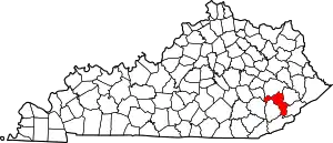 Location of Perry County, Kentucky | |
| CDPs | ||
| Other unincorporated communities |
| |
| Ghost town | ||
| Former mining towns | ||
| Post offices | ||