New Dayton | |
|---|---|
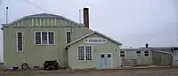
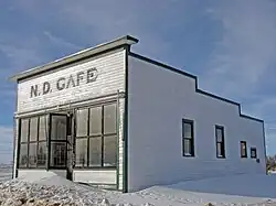 Repainted N.D. Cafe, 2008 | |
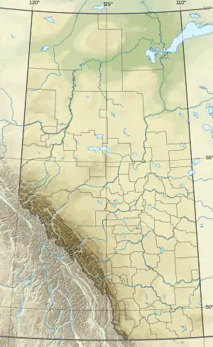 New Dayton Location of New Dayton  New Dayton New Dayton (Canada) | |
| Coordinates: 49°25′36″N 112°22′46″W / 49.42667°N 112.37944°W | |
| Country | Canada |
| Province | Alberta |
| Region | Southern Alberta |
| Census division | 2 |
| Municipal district | County of Warner No. 5 |
| Government | |
| • Type | Unincorporated |
| • Governing body | County of Warner No. 5 Council |
| • MP | Rachael Harder |
| • MLA | Grant Hunter |
| Elevation | 975 m (3,199 ft) |
| Population (1991)[1] | |
| • Total | 47 |
| Time zone | UTC−07:00 (MST) |
| • Summer (DST) | UTC−06:00 (MDT) |
| Postal code span | |
| Area code | +1-403 |
| Highways | Highway 4 |
| Waterways | Tyrrell Lake |
New Dayton is a hamlet in southern Alberta, Canada within the County of Warner No. 5.[2] It is located on Highway 4 between the villages of Stirling and Warner, approximately 48 kilometres (30 mi) southeast of Lethbridge. New Dayton was named for their former home by settlers from Dayton, Ohio.[3]
Demographics
New Dayton recorded a population of 47 in the 1991 Census of Population conducted by Statistics Canada.[1]
Services and amenities
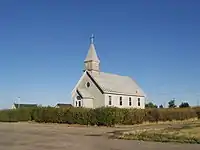
Church in New Dayton
New Dayton School located in New Dayton
The hamlet has a ball diamond, a campground and a postal outlet.
See also
References
- 1 2 "91 Census: Unincorporated Places — Population and Dwelling Counts" (PDF). Statistics Canada. June 1993. Retrieved September 25, 2021.
- ↑ "Specialized and Rural Municipalities and Their Communities" (PDF). Alberta Municipal Affairs. January 12, 2022. Retrieved January 21, 2022.
- ↑ Marden, Ernest G.; Marden, Austin (2010). Community Place Names of Alberta. Lulu.com. p. 239. ISBN 978-1897472170. Retrieved September 1, 2017.
Places adjacent to New Dayton | ||||||||||||||||
|---|---|---|---|---|---|---|---|---|---|---|---|---|---|---|---|---|
| ||||||||||||||||
This article is issued from Wikipedia. The text is licensed under Creative Commons - Attribution - Sharealike. Additional terms may apply for the media files.