Meironiškiai | |
|---|---|
Village | |
 | |
 Meironiškiai Location in Lithuania 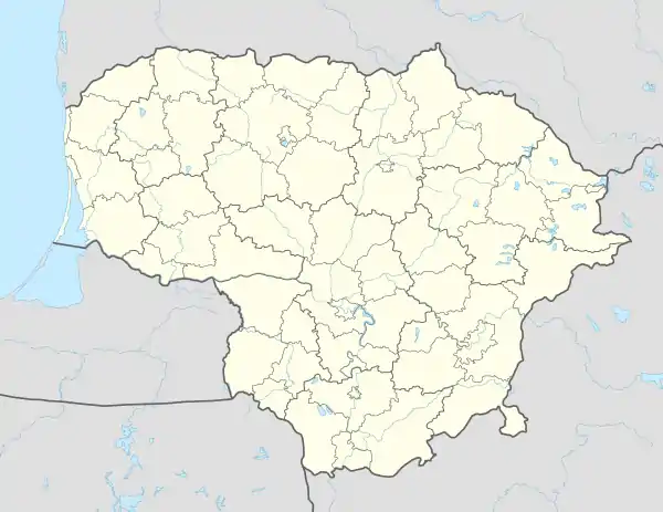 Meironiškiai Meironiškiai (Lithuania) | |
| Coordinates: 55°22′59″N 23°42′50″E / 55.38306°N 23.71389°E | |
| Country | |
| County | |
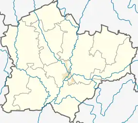
| Municipality | Kėdainiai district municipality |
| Eldership | Krakės Eldership |
| Population (2011) | |
| • Total | 269 |
| Time zone | UTC+2 (EET) |
| • Summer (DST) | UTC+3 (EEST) |
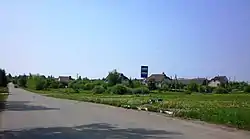
Meironiškiai (formerly Russian: Мейронишки, Polish: Mejroniszki)[1] is a village in Kėdainiai district municipality, in Kaunas County, in central Lithuania. According to the 2011 census, the village had a population of 269 people.[2] It is located 2.5 kilometres (1.6 mi) from Krakės town, by the Krakės-Josvainiai road, nearby the Smilgaitis and the Dangaučius rivers. There are a shop, a community house, a medicine station, a farm in Meironiškiai. Two big stones standing in the village are declared as a nature heritage object.
History
Meironiškiai developed into a bigger settlement during the Soviet era, as it was a kolkhoz center.[3]
Demography
|
| ||||||||||||||||||||||||||||||||||||
| Source: 1902, 1923, 1959 & 1970, 1979, 1989, 2001, 2011 | |||||||||||||||||||||||||||||||||||||
Images
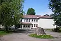 Community house
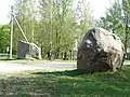 The Meironiškiai Stones
References
- ↑ "Mejroniszki". Geographical Dictionary of the Kingdom of Poland (in Polish). 15 pt. 2. Warszawa: Kasa im. Józefa Mianowskiego. 1902. p. 315.
- ↑ "2011 census". Statistikos Departamentas (Lithuania). Retrieved August 21, 2017.
- ↑ "Meironiškiai". Tarybų Lietuvos enciklopedija (in Lithuanian). Vol. 3. Vilnius: Vyriausioji enciklopedijų redakcija. 1987. p. 42.
This article is issued from Wikipedia. The text is licensed under Creative Commons - Attribution - Sharealike. Additional terms may apply for the media files.