Lopérec
Lopereg | |
|---|---|
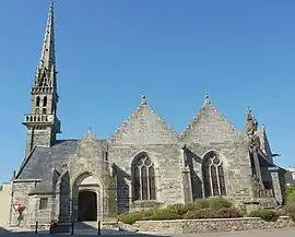 The parish church in Lopérec | |
Location of Lopérec | |
 Lopérec 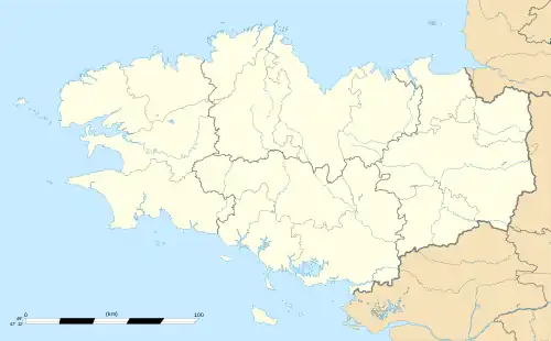 Lopérec | |
| Coordinates: 48°16′41″N 4°02′46″W / 48.2781°N 4.0461°W | |
| Country | France |
| Region | Brittany |
| Department | Finistère |
| Arrondissement | Châteaulin |
| Canton | Carhaix-Plouguer |
| Government | |
| • Mayor (2020–2026) | Jean-Yves Crenn[1] |
| Area 1 | 39.49 km2 (15.25 sq mi) |
| Population | 877 |
| • Density | 22/km2 (58/sq mi) |
| Time zone | UTC+01:00 (CET) |
| • Summer (DST) | UTC+02:00 (CEST) |
| INSEE/Postal code | 29139 /29590 |
| Elevation | 11–316 m (36–1,037 ft) |
| 1 French Land Register data, which excludes lakes, ponds, glaciers > 1 km2 (0.386 sq mi or 247 acres) and river estuaries. | |
Lopérec (French pronunciation: [lɔpeʁɛk]; Breton: Lopereg) is a commune in the Finistère department of Brittany in north-western France. It is part of the canton of Carhaix-Plouguer and the arrondissement of Châteaulin.[3] Lopérec is located within the Parc naturel régional d'Armorique. Its name derives from the sixth-century Cornish saint Perec.[4]
Population
| Year | Pop. | ±% p.a. |
|---|---|---|
| 1968 | 943 | — |
| 1975 | 769 | −2.87% |
| 1982 | 674 | −1.87% |
| 1990 | 723 | +0.88% |
| 1999 | 714 | −0.14% |
| 2009 | 810 | +1.27% |
| 2014 | 842 | +0.78% |
| 2020 | 877 | +0.68% |
| Source: INSEE[5] | ||
Inhabitants of Lopérec are called Lopérécois in French.
See also
References
- ↑ "Répertoire national des élus: les maires". data.gouv.fr, Plateforme ouverte des données publiques françaises (in French). 2 December 2020.
- ↑ "Populations légales 2020". The National Institute of Statistics and Economic Studies. 29 December 2022.
- ↑ "Commune de Lopérec". INSEE. Retrieved 16 July 2021.
- ↑ "La ville de Lopérec". Mairie de Lopérec. Retrieved 22 November 2023.
- ↑ Population en historique depuis 1968, INSEE
External links
- Official website (in French)
- Base Mérimée: Search for heritage in the commune, Ministère français de la Culture. (in French)
- Mayors of Finistère Association (in French)
Wikimedia Commons has media related to Lopérec.
This article is issued from Wikipedia. The text is licensed under Creative Commons - Attribution - Sharealike. Additional terms may apply for the media files.