Lhuis | |
|---|---|
Commune | |
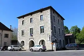 Town hall | |
.svg.png.webp) Coat of arms | |
Location of Lhuis | |
 Lhuis  Lhuis | |
| Coordinates: 45°45′00″N 5°32′00″E / 45.75°N 5.5333°E | |
| Country | France |
| Region | Auvergne-Rhône-Alpes |
| Department | Ain |
| Arrondissement | Belley |
| Canton | Lagnieu |
| Government | |
| • Mayor (2020–2026) | Emmanuel Ginet[1] |
| Area 1 | 24.43 km2 (9.43 sq mi) |
| Population | 893 |
| • Density | 37/km2 (95/sq mi) |
| Time zone | UTC+01:00 (CET) |
| • Summer (DST) | UTC+02:00 (CEST) |
| INSEE/Postal code | 01216 /01680 |
| Elevation | 201–1,020 m (659–3,346 ft) (avg. 395 m or 1,296 ft) |
| 1 French Land Register data, which excludes lakes, ponds, glaciers > 1 km2 (0.386 sq mi or 247 acres) and river estuaries. | |
Lhuis (French pronunciation: [lɥi]) is a commune in the Ain department in eastern France.
It is located in the Bugey region at the southern end of the Jura mountains. It lies between Lyon and Aix-les-Bains, about 60 km (37 mi) from each.
Population
|
|
See also
References
- ↑ "Répertoire national des élus: les maires". data.gouv.fr, Plateforme ouverte des données publiques françaises (in French). 2 December 2020.
- ↑ "Populations légales 2020". The National Institute of Statistics and Economic Studies. 29 December 2022.
External links
Wikimedia Commons has media related to Lhuis.
- (in French) Official site
- (in French) Tourist office
This article is issued from Wikipedia. The text is licensed under Creative Commons - Attribution - Sharealike. Additional terms may apply for the media files.