Buellas | |
|---|---|
Commune | |
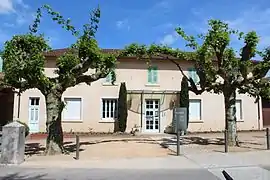 Town hall | |
.svg.png.webp) Coat of arms | |
Location of Buellas | |
 Buellas  Buellas | |
| Coordinates: 46°12′00″N 5°08′00″E / 46.2°N 5.1333°E | |
| Country | France |
| Region | Auvergne-Rhône-Alpes |
| Department | Ain |
| Arrondissement | Bourg-en-Bresse |
| Canton | Attignat |
| Intercommunality | Bassin de Bourg-en-Bresse |
| Government | |
| • Mayor (2020–2026) | Michel Chanel[1] |
| Area 1 | 10.21 km2 (3.94 sq mi) |
| Population | 1,825 |
| • Density | 180/km2 (460/sq mi) |
| Time zone | UTC+01:00 (CET) |
| • Summer (DST) | UTC+02:00 (CEST) |
| INSEE/Postal code | 01065 /01310 |
| Elevation | 206–266 m (676–873 ft) |
| 1 French Land Register data, which excludes lakes, ponds, glaciers > 1 km2 (0.386 sq mi or 247 acres) and river estuaries. | |
Buellas (French pronunciation: [bɥɛlas] ⓘ; Arpitan: Bouèla) is a commune in the Ain department in eastern France.
Geography
Buellas is located between the plain of Bresse and the plateau of Dombes. The Veyle forms the commune's northeastern border.
Population
| Year | Pop. | ±% p.a. |
|---|---|---|
| 1968 | 687 | — |
| 1975 | 792 | +2.05% |
| 1982 | 1,006 | +3.48% |
| 1990 | 1,162 | +1.82% |
| 1999 | 1,288 | +1.15% |
| 2007 | 1,633 | +3.01% |
| 2012 | 1,714 | +0.97% |
| 2017 | 1,782 | +0.78% |
| Source: INSEE[3] | ||
Sights
- Parc botanique de la Teyssonnière, a botanical park
See also
References
- ↑ "Répertoire national des élus: les maires" (in French). data.gouv.fr, Plateforme ouverte des données publiques françaises. 13 September 2022.
- ↑ "Populations légales 2020". The National Institute of Statistics and Economic Studies. 29 December 2022.
- ↑ Population en historique depuis 1968, INSEE
External links
Wikimedia Commons has media related to Buellas.
This article is issued from Wikipedia. The text is licensed under Creative Commons - Attribution - Sharealike. Additional terms may apply for the media files.