Le Liège | |
|---|---|
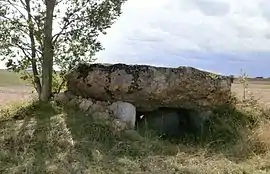 A dolmen known as "d'Hys", in Le Liège | |
.svg.png.webp) Coat of arms | |
Location of Le Liège | |
 Le Liège  Le Liège | |
| Coordinates: 47°13′46″N 1°06′16″E / 47.2294°N 1.1044°E | |
| Country | France |
| Region | Centre-Val de Loire |
| Department | Indre-et-Loire |
| Arrondissement | Loches |
| Canton | Loches |
| Intercommunality | CC Loches Sud Touraine |
| Government | |
| • Mayor (2020–2026) | Christophe Adjadj[1] |
| Area 1 | 11.15 km2 (4.31 sq mi) |
| Population | 326 |
| • Density | 29/km2 (76/sq mi) |
| Time zone | UTC+01:00 (CET) |
| • Summer (DST) | UTC+02:00 (CEST) |
| INSEE/Postal code | 37127 /37460 |
| Elevation | 93–141 m (305–463 ft) |
| 1 French Land Register data, which excludes lakes, ponds, glaciers > 1 km2 (0.386 sq mi or 247 acres) and river estuaries. | |
Le Liège (French pronunciation: [lə ljɛʒ] ⓘ) is a commune in the Indre-et-Loire department in central France.
Population
| Year | Pop. | ±% p.a. |
|---|---|---|
| 1968 | 250 | — |
| 1975 | 203 | −2.93% |
| 1982 | 186 | −1.24% |
| 1990 | 209 | +1.47% |
| 1999 | 227 | +0.92% |
| 2007 | 335 | +4.99% |
| 2012 | 340 | +0.30% |
| 2017 | 364 | +1.37% |
| Source: INSEE[3] | ||
See also
References
- ↑ "Répertoire national des élus: les maires". data.gouv.fr, Plateforme ouverte des données publiques françaises (in French). 9 August 2021.
- ↑ "Populations légales 2020". The National Institute of Statistics and Economic Studies. 29 December 2022.
- ↑ Population en historique depuis 1968, INSEE
Wikimedia Commons has media related to Le Liège.
This article is issued from Wikipedia. The text is licensed under Creative Commons - Attribution - Sharealike. Additional terms may apply for the media files.