Azay-sur-Cher | |
|---|---|
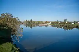 The Cher river in Azay-sur-Cher | |
.svg.png.webp) Coat of arms | |
Location of Azay-sur-Cher | |
 Azay-sur-Cher  Azay-sur-Cher | |
| Coordinates: 47°21′00″N 0°50′49″E / 47.35°N 0.8469°E | |
| Country | France |
| Region | Centre-Val de Loire |
| Department | Indre-et-Loire |
| Arrondissement | Tours |
| Canton | Bléré |
| Intercommunality | CC Touraine-Est Vallées |
| Government | |
| • Mayor (2020–2026) | Janick Alary[1] |
| Area 1 | 22.85 km2 (8.82 sq mi) |
| Population | 3,089 |
| • Density | 140/km2 (350/sq mi) |
| Time zone | UTC+01:00 (CET) |
| • Summer (DST) | UTC+02:00 (CEST) |
| INSEE/Postal code | 37015 /37270 |
| Elevation | 48–103 m (157–338 ft) |
| 1 French Land Register data, which excludes lakes, ponds, glaciers > 1 km2 (0.386 sq mi or 247 acres) and river estuaries. | |
Azay-sur-Cher (French pronunciation: [azɛ syʁ ʃɛʁ], Azay on Cher) is a commune in the Indre-et-Loire department in central France. It is twinned with Bedale, North Yorkshire, UK.
Population
|
| ||||||||||||||||||||||||||||||||||||||||||||||||||||||||||||||||||||||||||||||||||||||||||||||||||||||||||||||||||
| Source: EHESS[3] and INSEE (1968-2017)[4] | |||||||||||||||||||||||||||||||||||||||||||||||||||||||||||||||||||||||||||||||||||||||||||||||||||||||||||||||||||
See also
References
- ↑ "Répertoire national des élus: les maires". data.gouv.fr, Plateforme ouverte des données publiques françaises (in French). 2 December 2020.
- ↑ "Populations légales 2020". The National Institute of Statistics and Economic Studies. 29 December 2022.
- ↑ Des villages de Cassini aux communes d'aujourd'hui: Commune data sheet Azay-sur-Cher, EHESS (in French).
- ↑ Population en historique depuis 1968, INSEE
Wikimedia Commons has media related to Azay-sur-Cher.
This article is issued from Wikipedia. The text is licensed under Creative Commons - Attribution - Sharealike. Additional terms may apply for the media files.