Juvigny les Vallées | |
|---|---|
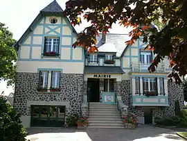 The town hall in Juvigny | |
Location of Juvigny les Vallées | |
 Juvigny les Vallées  Juvigny les Vallées | |
| Coordinates: 48°40′41″N 1°01′12″W / 48.678°N 1.020°W | |
| Country | France |
| Region | Normandy |
| Department | Manche |
| Arrondissement | Avranches |
| Canton | Isigny-le-Buat |
| Intercommunality | CA Mont-Saint-Michel-Normandie |
| Government | |
| • Mayor (2020–2026) | Xavier Tassel[1] |
| Area 1 | 57.25 km2 (22.10 sq mi) |
| Population | 1,683 |
| • Density | 29/km2 (76/sq mi) |
| Time zone | UTC+01:00 (CET) |
| • Summer (DST) | UTC+02:00 (CEST) |
| INSEE/Postal code | 50260 /50520 |
| 1 French Land Register data, which excludes lakes, ponds, glaciers > 1 km2 (0.386 sq mi or 247 acres) and river estuaries. | |
Juvigny les Vallées (French pronunciation: [ʒyviɲi le vale]) is a commune in the department of Manche, northwestern France. The municipality was established on 1 January 2017 by merger of the former communes of Juvigny-le-Tertre (the seat), La Bazoge, Bellefontaine, Chasseguey, Chérencé-le-Roussel, Le Mesnil-Rainfray and Le Mesnil-Tôve.[3]
See also
References
Wikimedia Commons has media related to Juvigny les Vallées.
- ↑ "Répertoire national des élus: les maires" (in French). data.gouv.fr, Plateforme ouverte des données publiques françaises. 13 September 2022.
- ↑ "Populations légales 2020". The National Institute of Statistics and Economic Studies. 29 December 2022.
- ↑ Arrêté préfectoral 8 July 2016 (in French)
This article is issued from Wikipedia. The text is licensed under Creative Commons - Attribution - Sharealike. Additional terms may apply for the media files.