Inzersdorf-Getzersdorf | |
|---|---|
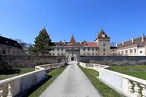 Walpersdorf Castle in Inzersdorf-Getzersdorf | |
 Coat of arms | |
 Inzersdorf-Getzersdorf Location within Austria | |
| Coordinates: 48°19′N 15°40′E / 48.317°N 15.667°E | |
| Country | Austria |
| State | Lower Austria |
| District | Sankt Pölten-Land |
| Government | |
| • Mayor | Mag. Ewald Gorth |
| Area | |
| • Total | 13.63 km2 (5.26 sq mi) |
| Elevation | 260 m (850 ft) |
| Population (2018-01-01)[2] | |
| • Total | 1,581 |
| • Density | 120/km2 (300/sq mi) |
| Time zone | UTC+1 (CET) |
| • Summer (DST) | UTC+2 (CEST) |
| Postal code | 3130 |
| Area code | 02782 |
| Website | http://www.inzersdorf-getzersdorf.gv.at |
Inzersdorf-Getzersdorf is a town in the district of Sankt Pölten-Land in the Austrian state of Lower Austria.
Population
| Year | Pop. | ±% |
|---|---|---|
| 1971 | 1,143 | — |
| 1981 | 1,133 | −0.9% |
| 1991 | 1,335 | +17.8% |
| 2001 | 1,399 | +4.8% |
References
- ↑ "Dauersiedlungsraum der Gemeinden Politischen Bezirke und Bundesländer - Gebietsstand 1.1.2018". Statistics Austria. Retrieved 10 March 2019.
- ↑ "Einwohnerzahl 1.1.2018 nach Gemeinden mit Status, Gebietsstand 1.1.2018". Statistics Austria. Retrieved 9 March 2019.
This article is issued from Wikipedia. The text is licensed under Creative Commons - Attribution - Sharealike. Additional terms may apply for the media files.